Maps and aerial photographs from the University Library’s collections that have been digitized can be found in the Library’s Digital Collections. The items come from a number of different libraries within the University Library system: Map Library, Illinois History and Lincoln Collections, Rare Book & Manuscript Library, Student Life and Culture Archives, and University Archives.
Images continue to be added to collections, and new collections are being created.
Many of the items included are in the public domain and may be used freely. The University Library requests the inclusion of an acknowledgement statement if images are being republished or used in a presentation. Sample statements are included in the description for each item.
1920s
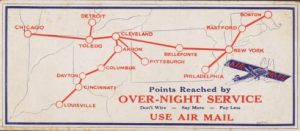 The 1920s were a decade of change. Technology was changing rapidly – automobiles became more common, buildings in city centers were taller, radio made faraway places seem closer. In the United States, the last of the American troops returned after serving during the First World War; for a short while, the production and sales of alcohol was prohibited; and women voted in a national election for the first time. The events of the First World War had created distance from the nineteenth century, and the United States was looking forward toward the future. Society in the United States was changing – more women were working outside of their homes and more people lived in cities than in the countryside. But with all these advancements, many reflected in the phrase “the Roaring 20s,” there was also a dark side to the decade filled with social unrest, nativism, and racism. The maps in this collection reflect the trends and mores of the times.
Aerial Photography Index Maps
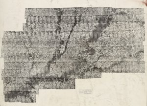 The Map Library maintains a comprehensive collection of over 190,000 aerial photographs for all Illinois counties, with the earliest photographs from the late 1930s and the most recent from 2005. Each set of photographs has its own index which must be used to identify photographs needed from the collection. The indexes have been scanned so that distant users can identify and request photographs without traveling to the Map Library.
Aerial Stereograms
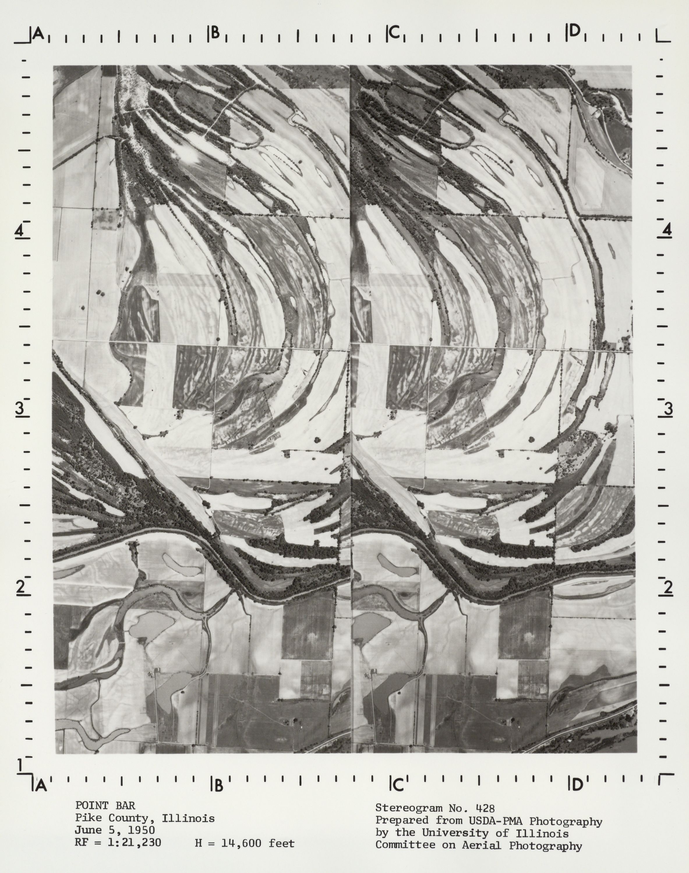 The University of Illinois at Urbana-Champaign Committee on Aerial Photography began to prepare a set of aerial stereogram photographs, showing a variety of natural and man-made features, to support instruction in aerial photography interpretation in 1959. The stereograms were created primarily from United States government photography. Source image dates range between 1936 and 1970. Brief descriptions of each stereogram are available in a separately-published catalog, “University of Illinois Catalog of Stereogram Aerial Photographs.” The catalog is included in the scanned collection.
Allerton Park Maps and Air Photos
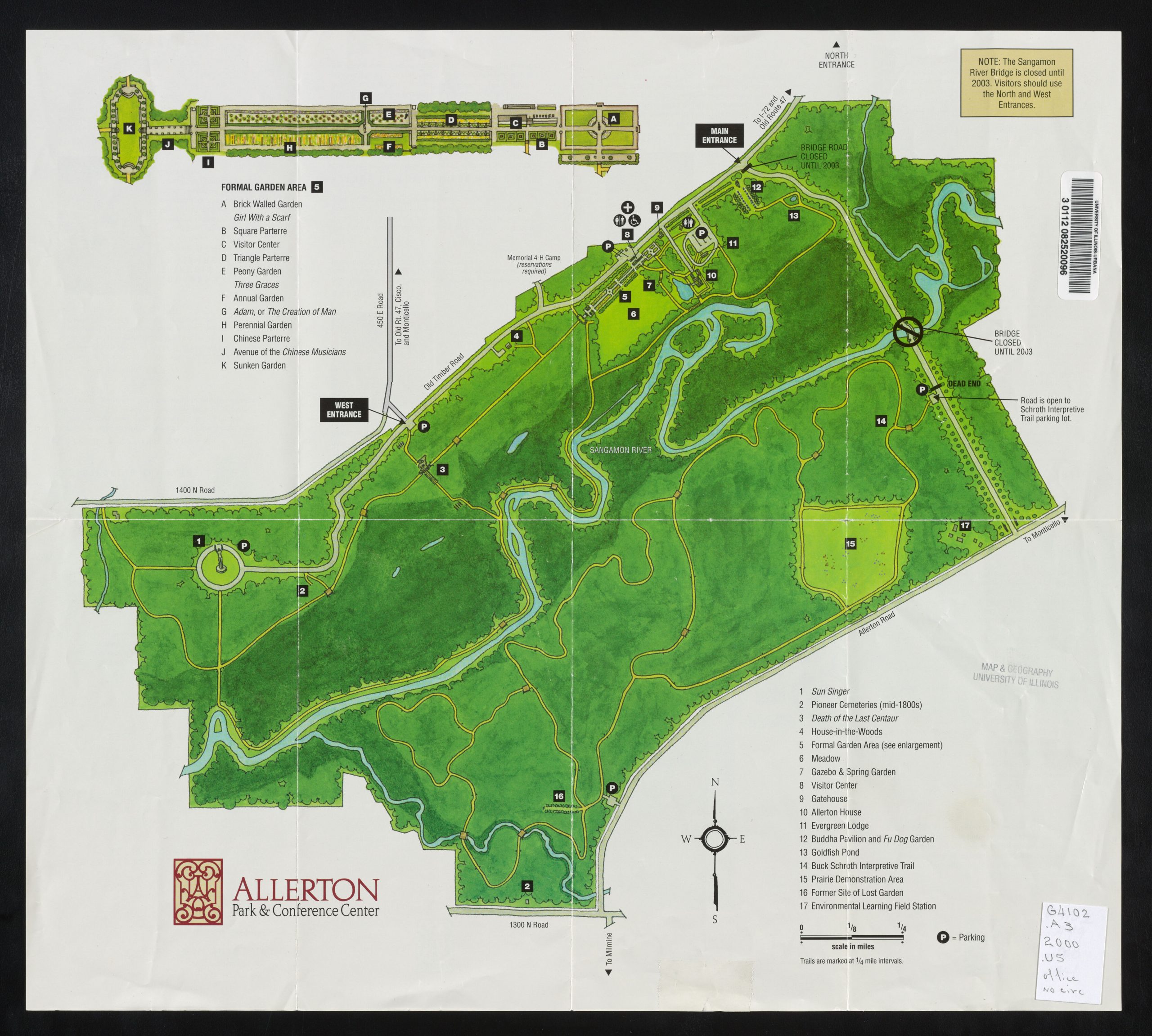 Allerton Park was deeded to the University of Illinois by Robert Allerton in 1946. The property includes woodlands, prairies, and a meadow; a mansion with a variety of formal gardens; and an Illinois 4-H camp. The property very much reflects Allerton’s passions for art and landscape as art. This collection contains maps and air photos of or centered on Allerton Park. Some maps about the planned, but never constructed Oakley Reservoir, are also included.
American Empire Maps
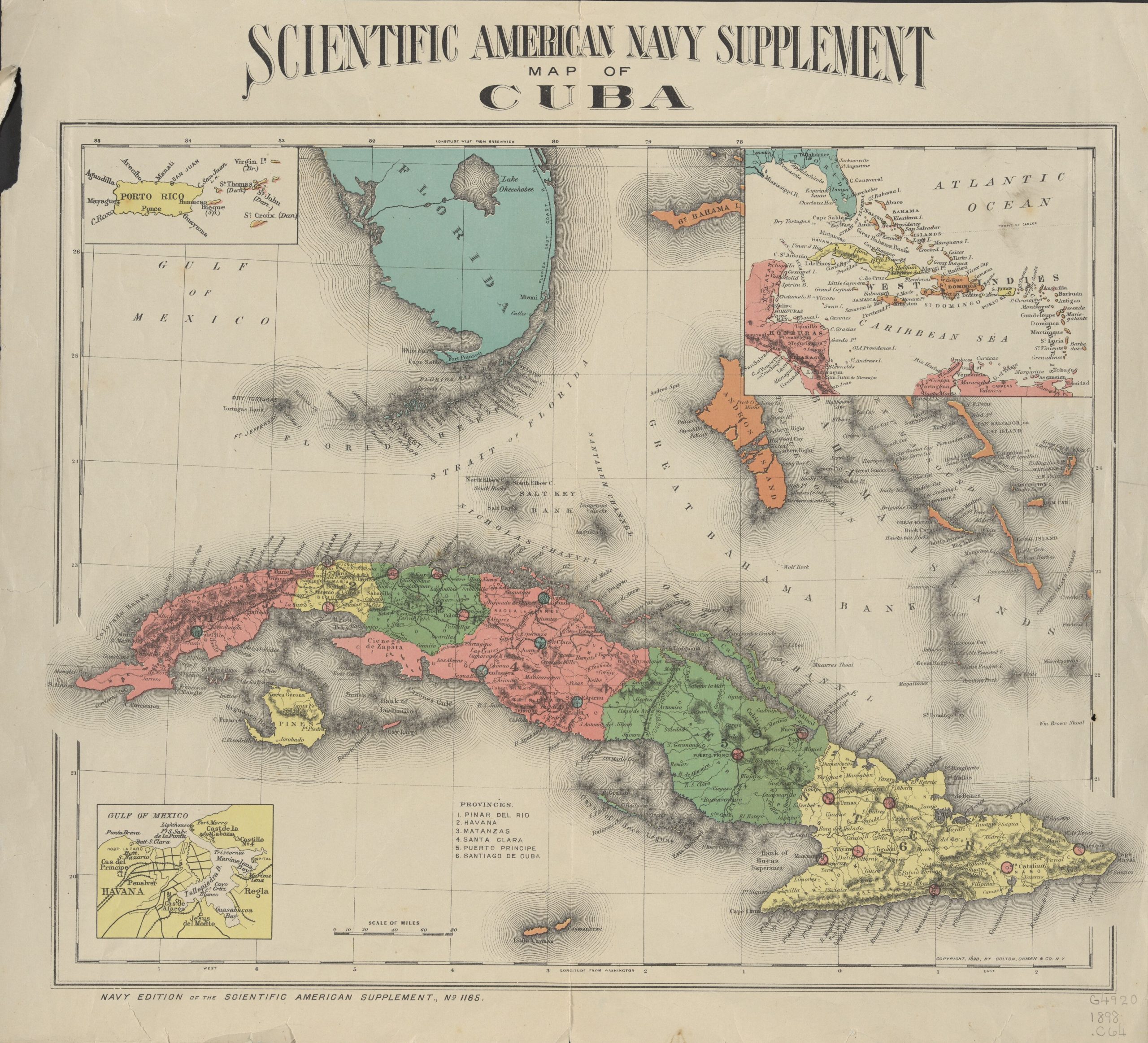 The United States was an established world presence by the early 20th century. The nation was the world’s leading agricultural producer, dominated world markets for petroleum products, was the world’s largest producer of steel, and had not only expanded across the North American continent from the Atlantic to the Pacific but also had administrative control over remote territories. The maps in the this collection range in date from approximately 1890 to 1910 and include maps from the Spanish-American War and maps of overseas territories acquired through that conflict, maps of Hawaii and the Klondike gold rush, and maps of world’s fairs.
Civil War Maps
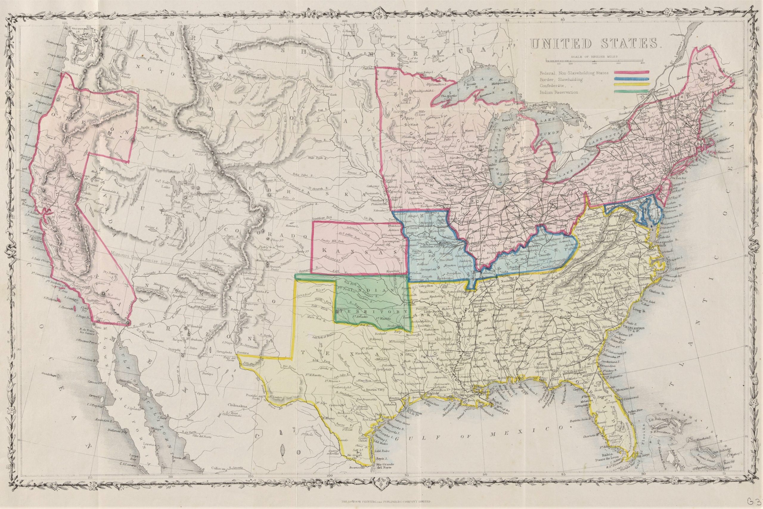 The Civil War Maps collection contains maps of the entire United States, regions, individual states, and specific locations. Especially notable are maps of Andersonville and Camp Douglas prisons, Bachmann panoramas, and maps from newspapers. Maps showing actions, events, and situations during the war as well as maps created immediately before and after the war are included.
Facsimile Map Collection
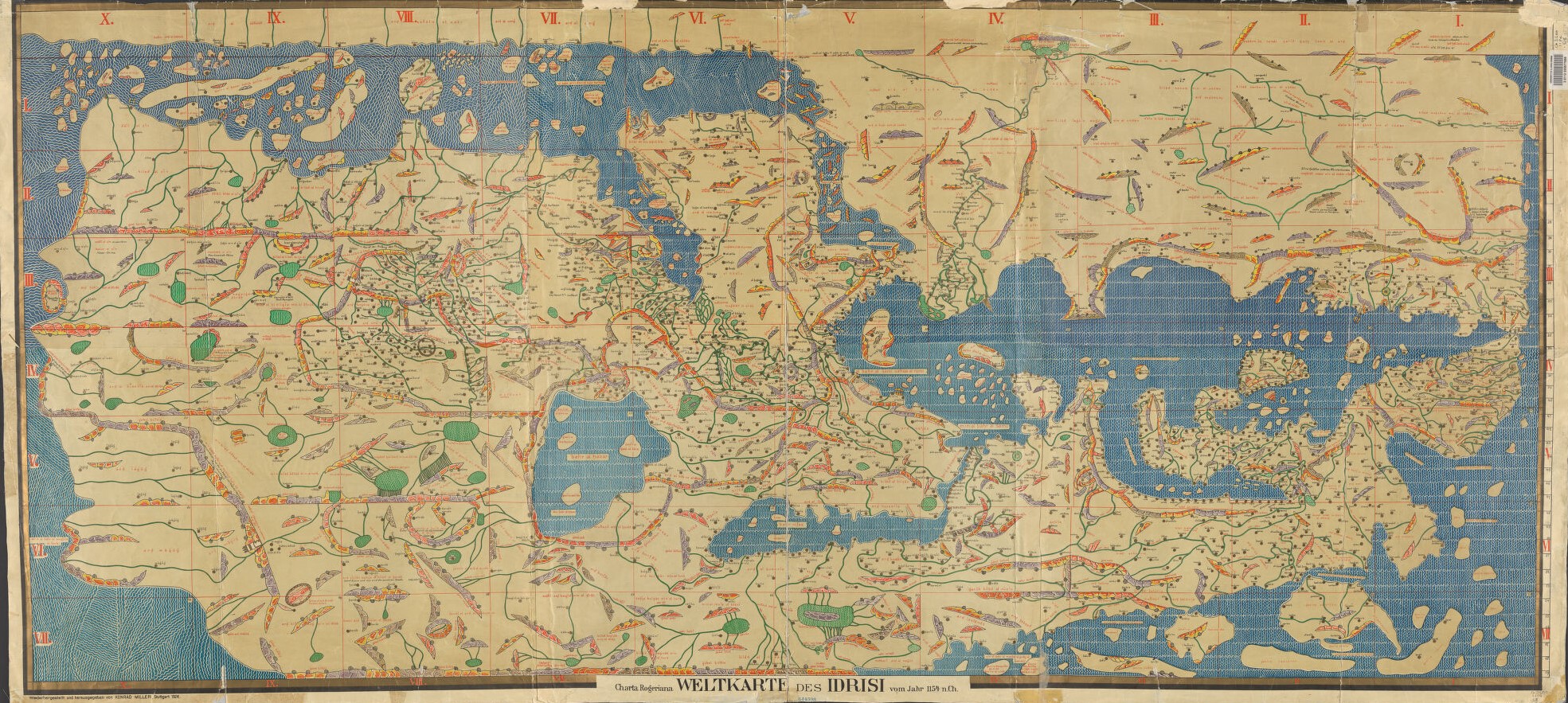 Map historians have relied on copies (facsimiles) of old maps for more than a century. In some cases, the copies they used were restrikes of images from original printing plates. Beginning in the middle of the 19th century, map collectors, initially individuals but later libraries and learned societies, collected original early maps and reprinted them in facsimile atlases. Nineteenth-century facsimiles were often lithographed prints of hand-traced maps. Not until the early 20th century did photography begin to play a larger role in creating facsimile images. The maps and atlases contained in this digital collection include some of the most important of the facsimiles published in the late 19th century including Wieder’s Monumenta Cartographica and Nordenskiöld’s Facsimile-Atlas to the Early History of Cartography.
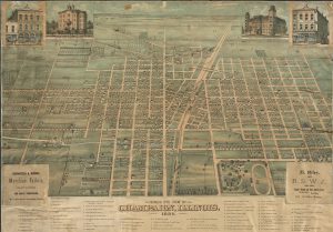
Historic Illinois County Atlases
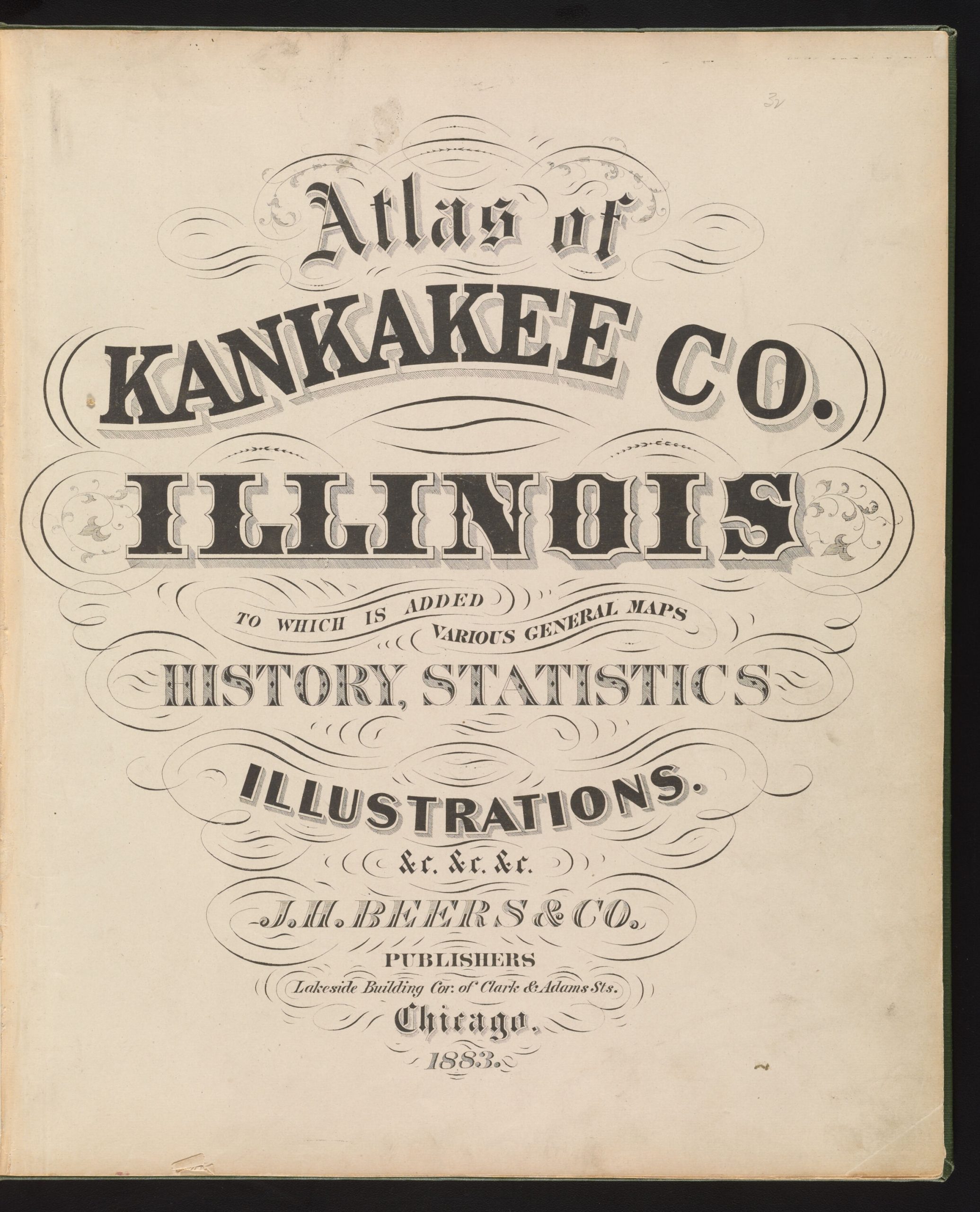 County atlases, which began to be produced after the Civil War, are a uniquely American nineteenth-century publication. By the 1880s, Chicago was a leading place of publication of these atlases, and many were created for Midwestern counties. The primary foci of the county atlases are township maps that show property ownership, roads, and railroads. Additional contents might include: county, state, and national maps; directories of businesses, county officials, landowners, and rural residents; photographs or drawings of residents, farms, homes, public buildings, churches, businesses, and prize livestock. The atlases are statements of personal, familial and civic pride.
Historical Maps Online
 This collection celebrates four centuries of mapping of Illinois and the Northwest Territories. Besides stand-alone maps and maps from atlases, the collection includes historic United States Geological Survey topographic quadrangles.
Mapping History at the University of Illinois Collection
 This collection contains maps of the University of Illinois, Champaign-Urbana, and Champaign County. The Mapping History project was a cross-campus, multi-department project supporting scholarship about and celebration of the University of Illinois at Urbana-Champaign.
Maps of Africa to 1900
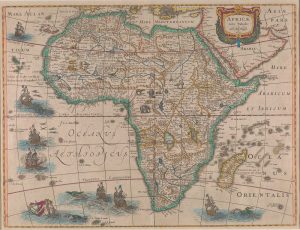 This collection contains images of maps listed in the bibliography Maps of Africa to 1900: A Checklist of Maps in Atlases and Geographical Journals in the Collections of the University of Illinois, Urbana-Champaign (Bassett & Scheven, Urbana: Graduate School of Library and Information Science, 2000). These maps can be found in map collections, atlases, and geographical journals in the University Library; a number of these scanned maps are privately owned.
Railroad Maps
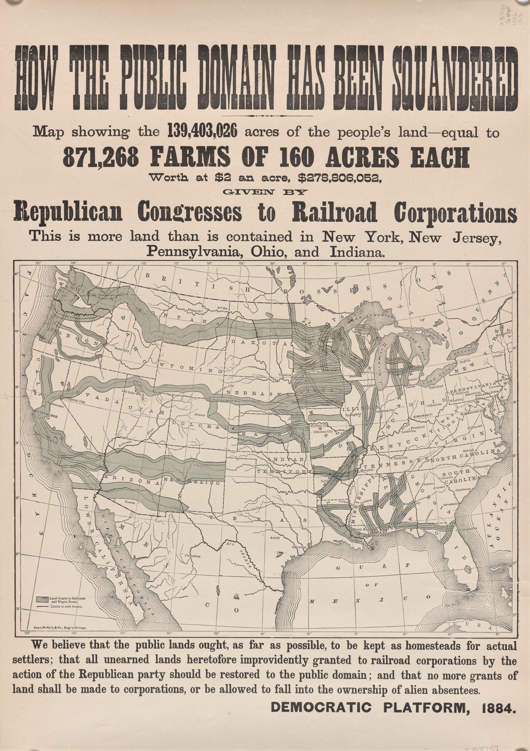 More than for any other country, railroads were a critical part of the shaping of the United States. They played an important role in the movement of population from the East Coast across the entire continent connecting the Atlantic and Pacific oceans, were the impetus behind the checkerboard pattern of federal and private landownership, and shaped the outcome of the Civil War. Chicago’s importance as a connecting point cannot be underestimated. This collection includes maps of Illinois, the United States, and North America from the 1840s into the Interwar Period.
River Maps
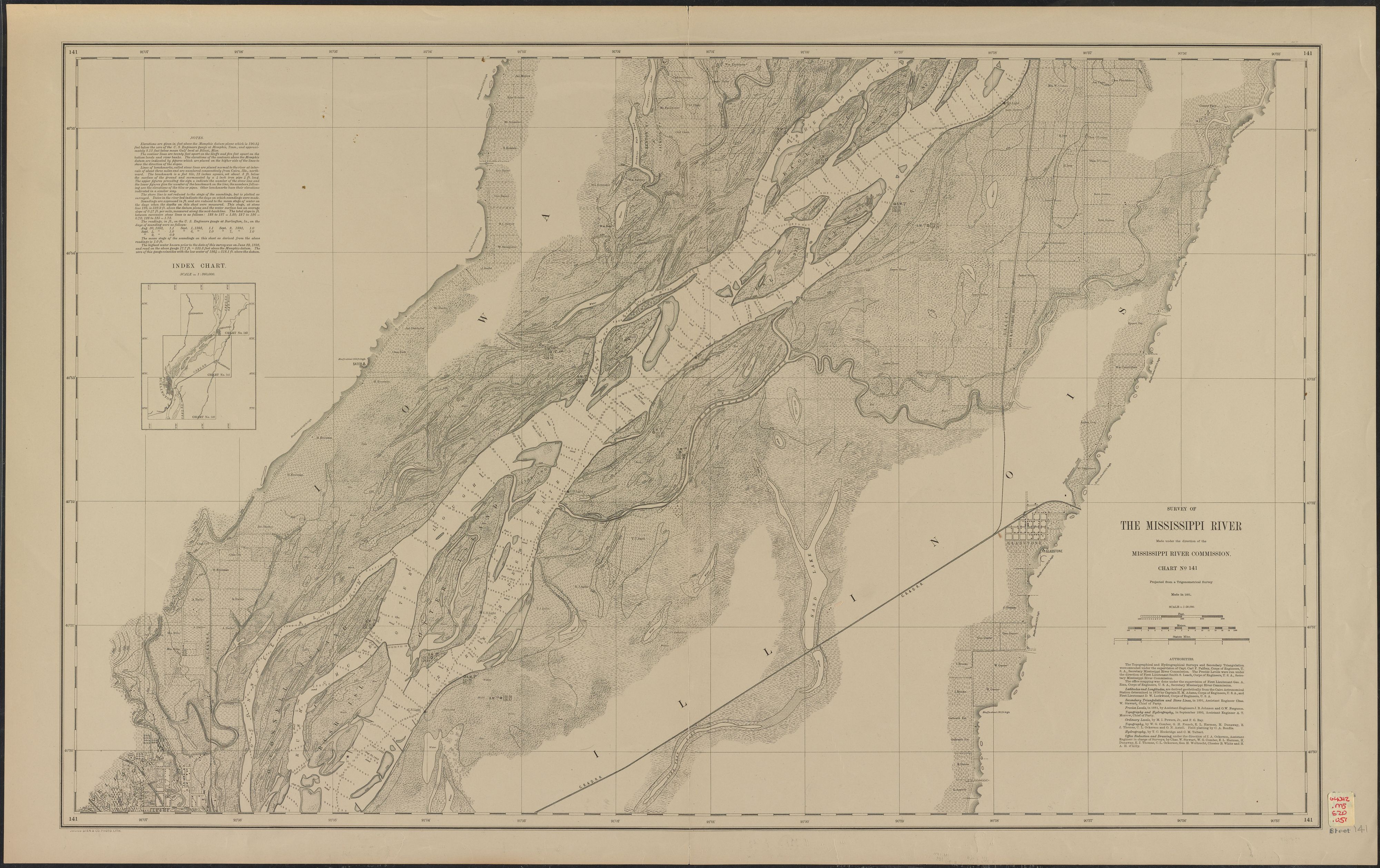 The importance of rivers to the state of Illinois cannot be underestimated. Rivers have historically been core to the transportation of people and goods in and out of the state. Besides the maps included in this collection of materials, aerial photographs that include rivers in Illinois as well as parts of rivers on the state’s borders can be found in sets of photographs for Illinois counties in the Map Library. Indexes for these sets are available online through the Digital Collection Aerial Photograph Index Maps. Older, smaller-scale maps that include rivers of Illinois and the upper Midwest may be viewed in the Historical Maps Online collection.
Sanborn Fire Insurance Maps
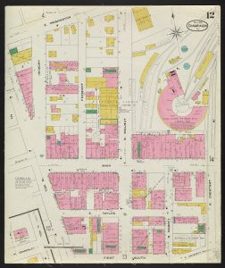 The Map Library’s collection of Sanborn fire insurance maps provides coverage for Illinois towns and cities only; rural sites are not included. The maps primarily provide information on the downtown areas of cities and adjoining residential areas from the 1880s through the first half of the 20th century. Additional years will be included as maps are released into the public domain. See the Map Library’s Sanborn Map webpages for information about these maps and additional, not yet scanned, holdings.
United States Department of Agriculture Soil Maps
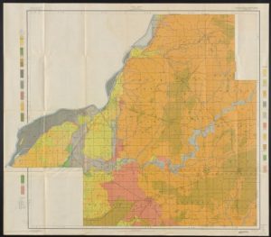 Recognizing that the characteristics of soil have a great impact on the quality and yield of crops, the United States Department of Agriculture Division of Soils, later Bureau of Soils, created soil survey reports and maps to document areas of and differences in soil types and to describe problems encountered by specific agricultural processes or crops. This collection consists of soil maps that accompanied annual soil reports published by the United States Department of Agriculture between 1899 and 1922. Each year’s report covered diverse and geographically scattered regions in the United States, often at the county level. Digitized texts can be found in the HathiTrust.
Vandermaelen Atlas Universel
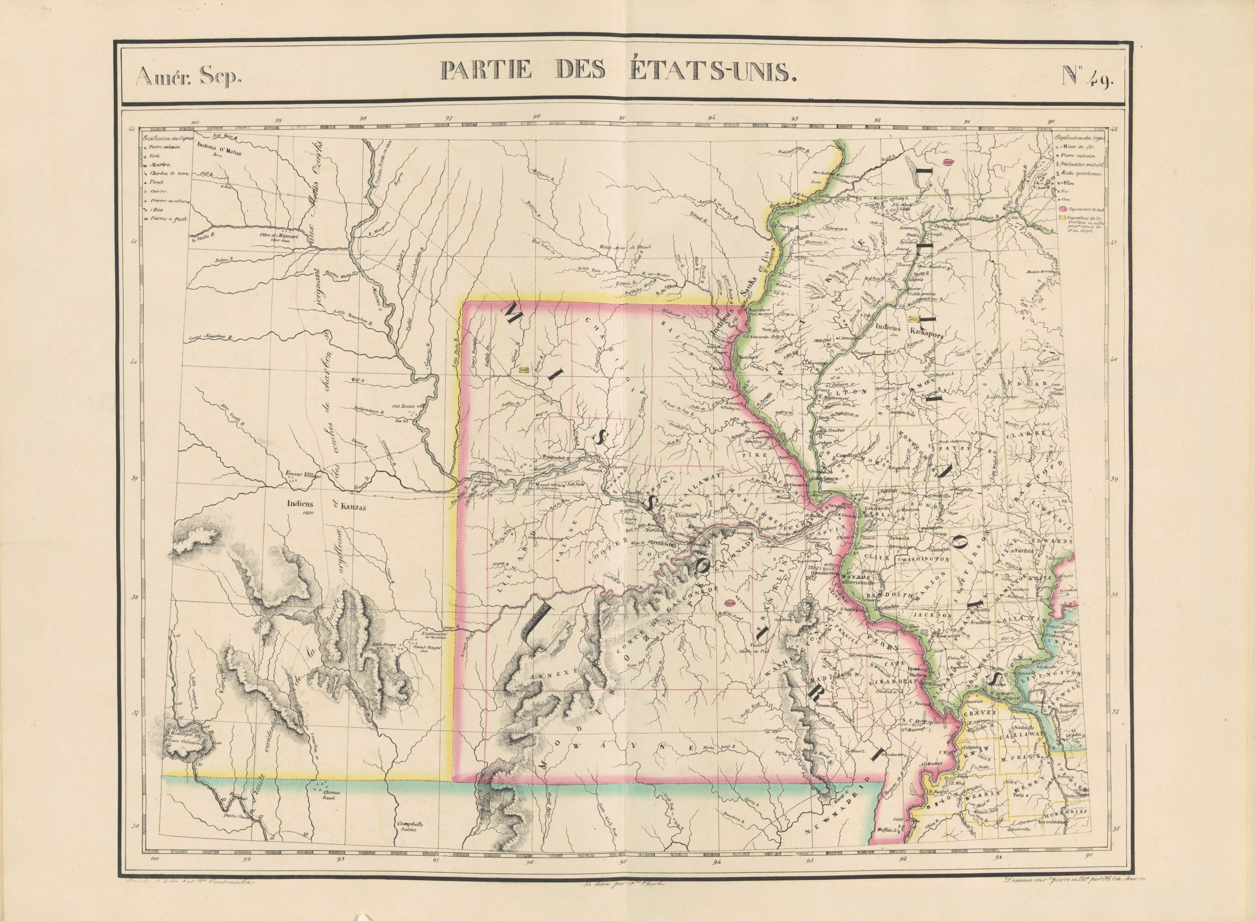 Atlas universel de géographie physique, politique, statistique et minéralogique : sur l’échelle de 1/1641836 ou d’une ligne par 1900 toises, created and published by Philippe Marie Guillaume Vandermaelen, is believed to be the first world atlas on a uniform scale. All of the maps, regardless of the area shown, are at the same scale and on the same conic projection. The sheets were published and distributed in installments between 1825 and 1827. The atlas is composed of 6 volumes, containing approximately 390 maps and 40 pages of statistical tables. Because all of the maps are at the same scale, areas of the world less well known by Europeans, such as Africa and western North America, are mapped at the same level of detail as Europe, making these maps some of the earliest and most detailed maps of otherwise unknown areas.
World War I Maps
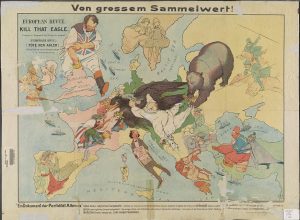 This collection contains maps and atlases published shortly before, during, and after World War I. Types of maps encompass propaganda maps, trench maps and other maps of battles and fronts, ethnographic and economic maps, maps and atlases for citizens at home, and maps created to support work of the United States delegation to the Paris Peace Conference.