New Acquisitions in the Map Library
Le Rève du Fou = The Madman’s Dream
September 7, 2022
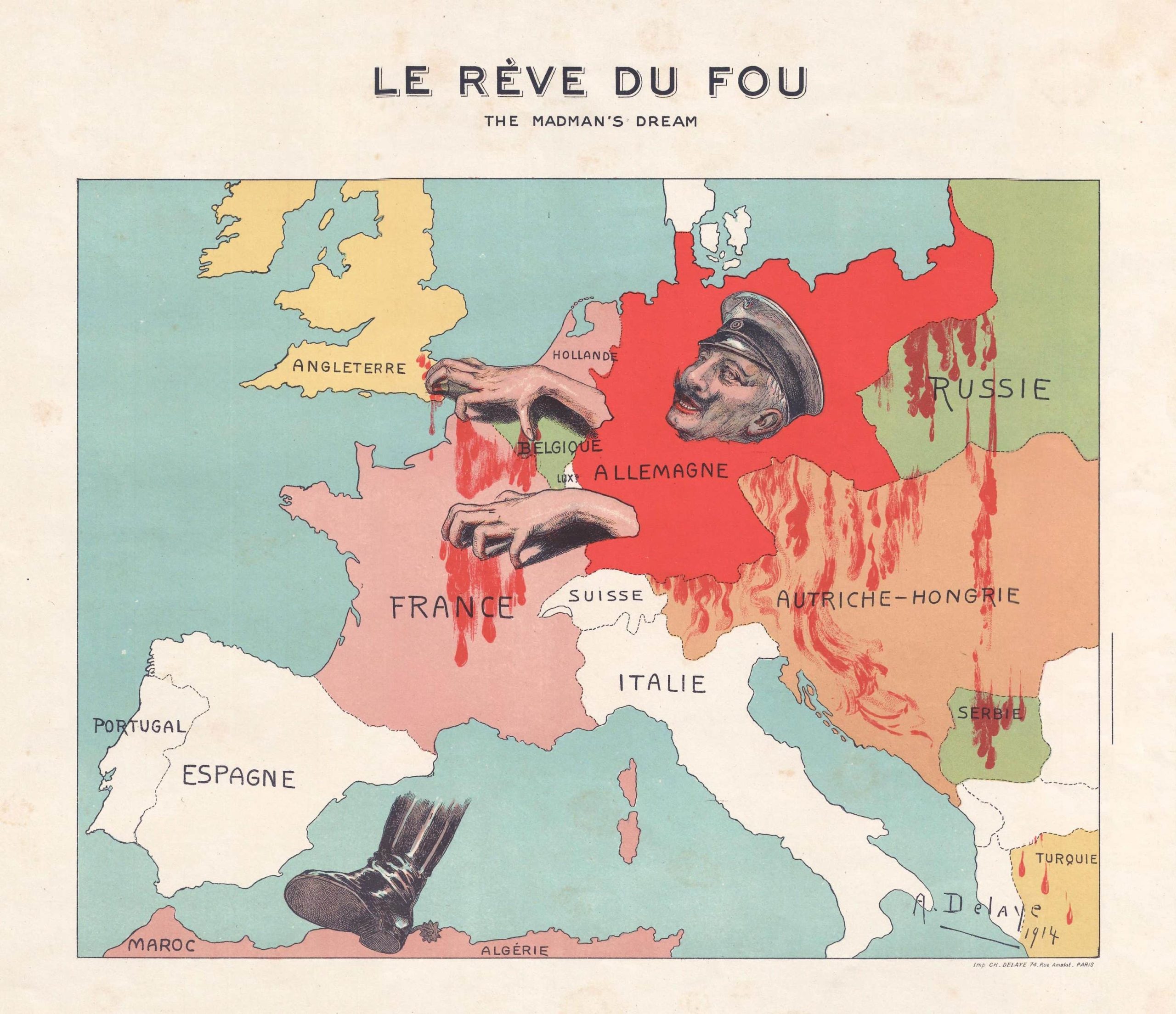 Published in 1914, Le Rève du Fou depicts Kaiser Wilhelm stalking across or through Europe. Only his head, grasping hands, and crushing right boot are depicted. Italy becomes his left leg. This map proved to have a treasure hunt embedded in it. The lower right corner includes an distinctive artist’s signature — A. Delaye. With some digging, and assistance from colleagues elsewhere in the University Library, we discovered that A. Delaye is Alice Delaye (1884-1963), a French painter and graphic artist. The map was printed by her father Charles Delaye. We will continue to investigate this work as it appears that there was at least one companion work. We do not know if this map was sold as a separate print or as part of a group of related graphics. The map has been scanned and is available for viewing and download in the Map Library’s World War I digital collection. Purchased with the assistance of a Library Friend.
Manuscript Map — Southern Illinois and Western Kentucky Coal and Iron Mining Regions, ca. 1848
September 7, 2022
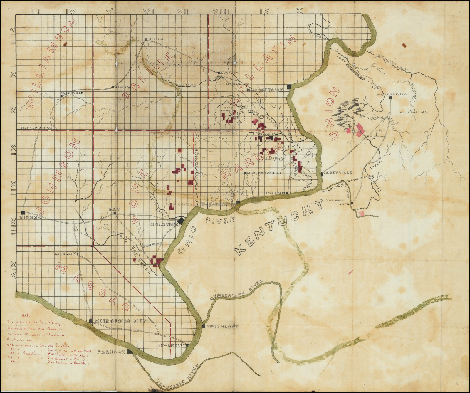 This manuscript map, drawn on oil cloth, focuses on salt works and coal and iron mining in southern Illinois and western Kentucky. Leases are marked in red. County boundaries and names, roads, towns, and streams are also included. The grid of townships is drawn on Illinois but there is no grid over Kentucky because Kentucky is surveyed using the metes and bounds system. The list in the lower left corner includes five properties in Illinois which could not be included on the map because the cartographer had no township information about their locations. Because of the inclusion of the Martha Furnace near the center of Hardin County, built in 1848 and in use until 1857, the map can be dated to as early as 1848. Interestingly, the Illinois Furnace, which was built in 1837 on Big Creek southwest of the future location of the Martha Furnace, is not indicated. The Illinois Furnace was larger, more profitable, and in operation longer than the Martha Furnace. Iron from both of these blast furnaces would have been shipped through Elizabethtown on the Ohio River. Acquired in part with the Bruce C. Creamer Fund.
City of Chicago, Illinois, where the Republican Nominating Convention will meet on May 16, 1860
September 6, 2022
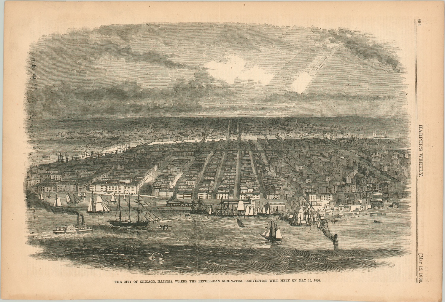 Published in Harper’s Weekly, May 12, 1860. Lincoln did not attend the 1860 nominating convention but he had positioned himself to be a success at the convention through speeches and the publication of his debates with Stephen Douglas as well as a biography. Lincoln relied on friends at the convention to advance his cause and was nominated on the third ballot. The convention was held at the “Wigwam,” a completely wooden two-story structure built on Lake Street near the Chicago River specifically to attract the 1860 convention to Chicago. The Wigwam was demolished sometime between 1867 and 1871.The Wigwam cannot be discerned in this birds-eye view; it would have been approximately in the center of the image on the east bank of the Chicago River between two bridges. The image has been scanned and is available for viewing and download through the Map Library’s Civil War Maps digital collection
Stanford’s Map of the United States (1901)
September 1, 2021
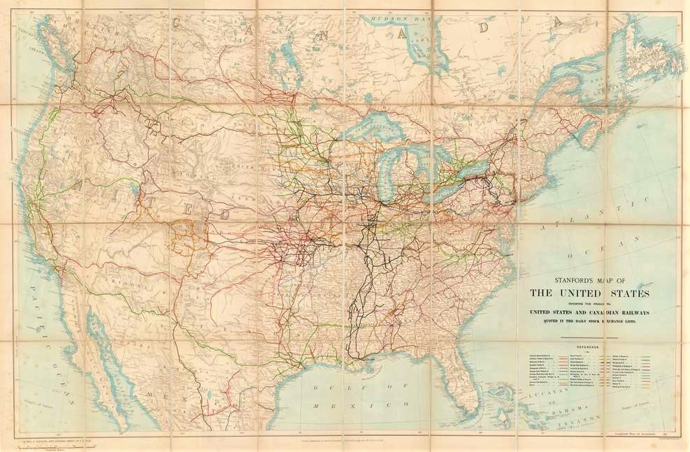 It is not widely known that European investors financed more than half of United States railroad growth in the 19th and early 20th centuries. This map, published in London, was intended for those remote investors, illustrating the extent of track owned by United States and Canadian railroad companies traded on the London Stock Exchange. There are only 2 other known copies of this map. This map has been scanned and is available for viewing and download through the Map Library’s Railroad Maps digital collection.
Saikin no Tōa keisei zukai = 最近の東亜形勢圖解
May 13, 2021
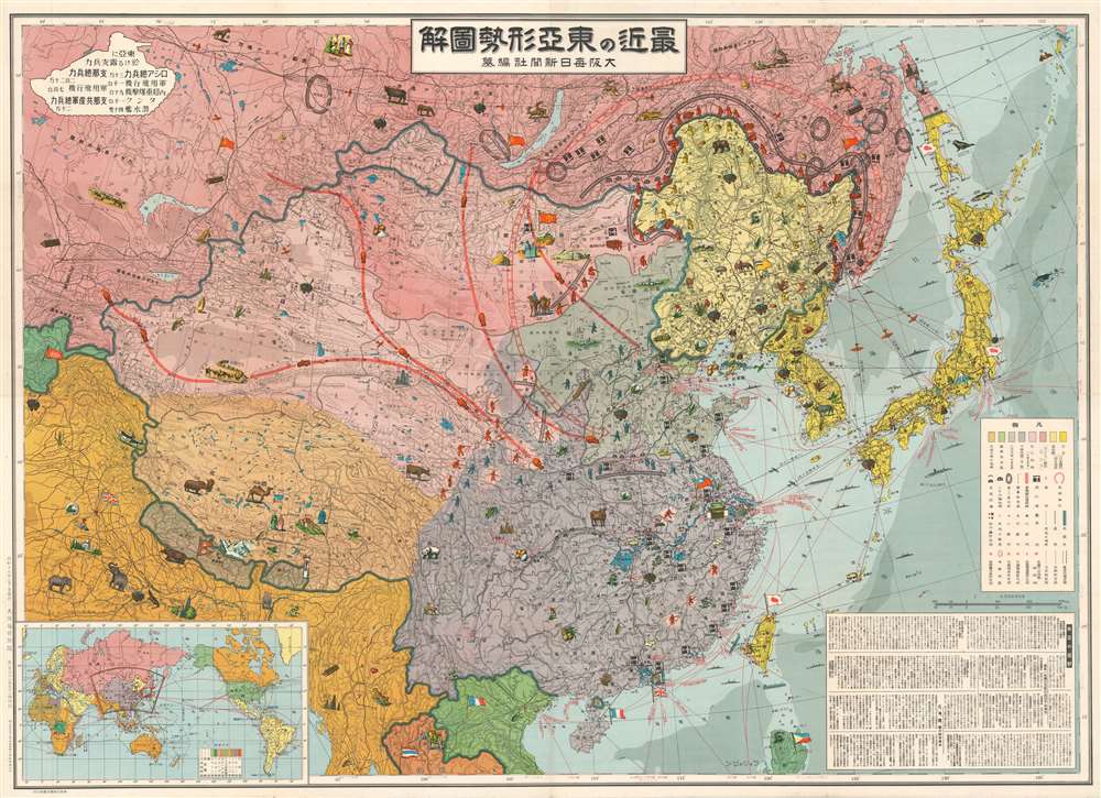 This map of East Asia was published in Japan in 1937. Centered on China, the map depicts tensions and military increases in in the years immediately before the beginning of World War Two. China is probably the center of the map because it was a region of contention between the Soviet Union and the Japanese Empire. The Soviet Union appears to be relatively natural resource poor in comparison to regions to its south, highlighting Japan’s needs to defend and establish or maintain control over these areas. The world map in the lower left depicts colonial interests of England, Italy, Japan, and the Soviet Union. Purchased with support from the GS Bonn Endowment Fund.
Anglo Saxondom Modern Israel
March 19, 2021
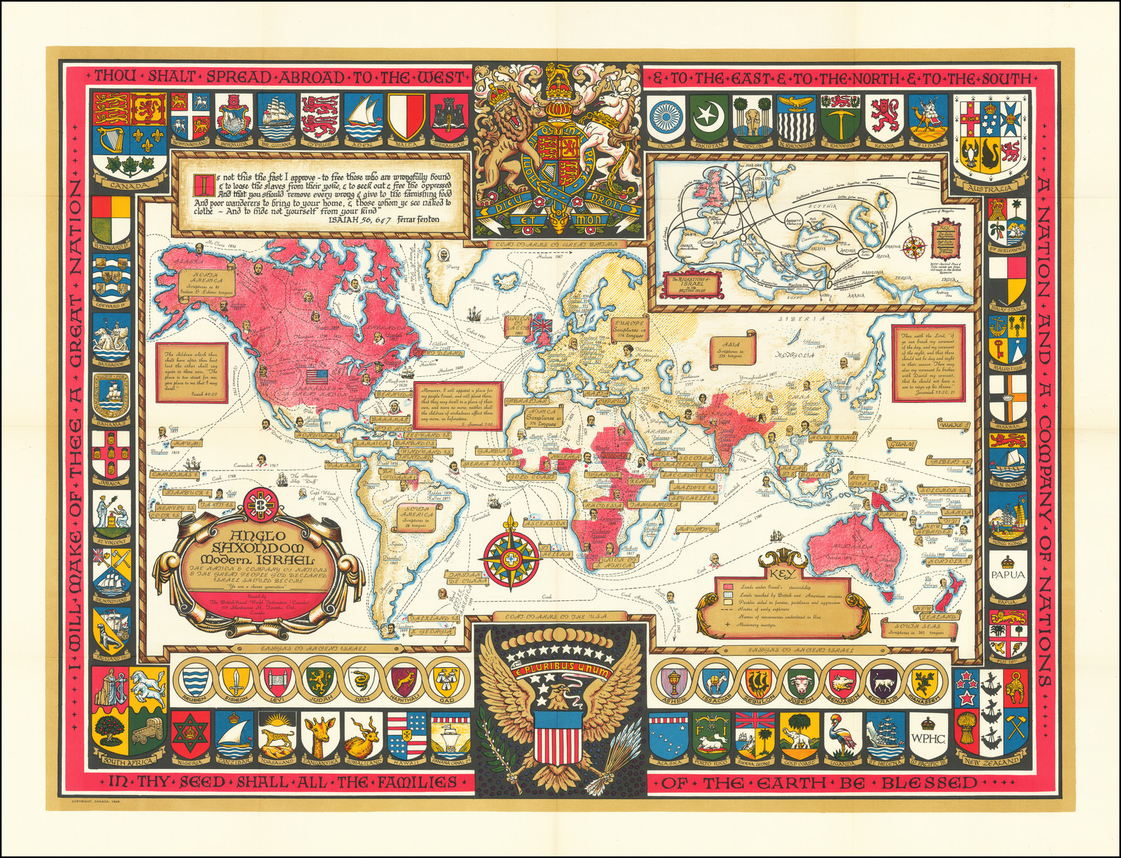 At first glance, this 1949 world map by the British Israel World Federation appears to be highlighting Anglo-American territories. But it actually demonstrates bold mid-century racial and ethnic centrism with underlying premises revolving around the Ten Lost Tribes of Israel (inset map showing the path of the Tribes from Egypt to Britain), the ancient descent of the British royal family, and the divine mandate given to Britain to create world order. Purchased with the support from the Richard Allen Avner and Elaine S. Avner Library Endowment Fund.
Panorama of the Mississippi Valley
March 8, 2021
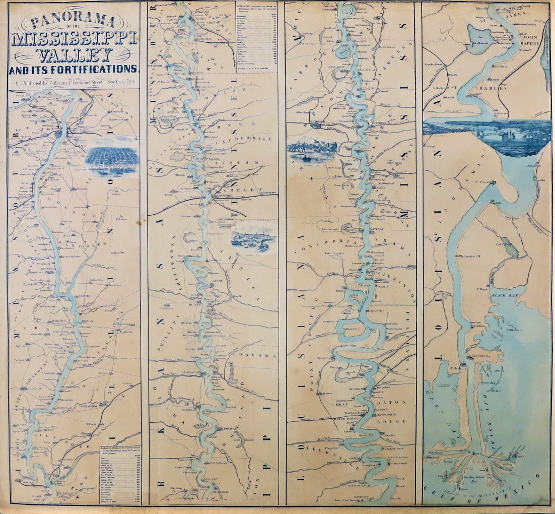 This 1863 map of the Mississippi River Valley, from the Missouri River confluence north of St. Louis to its mouth, includes the locations of fortifications and city panoramic views of St. Louis, Memphis, Vicksburg, and New Orleans. The entire leftmost (northernmost) panel shows the river along the west border of Illinois. The blue of the river and Gulf of Mexico was applied by hand; brush strokes and uneven color can be seen throughout the map. This map has been scanned and is available for viewing and download through the Map Library’s River Maps digital collection. Purchased with the assistance of a Library Friend.
Map of the Mexican National Railway
February 22, 2021
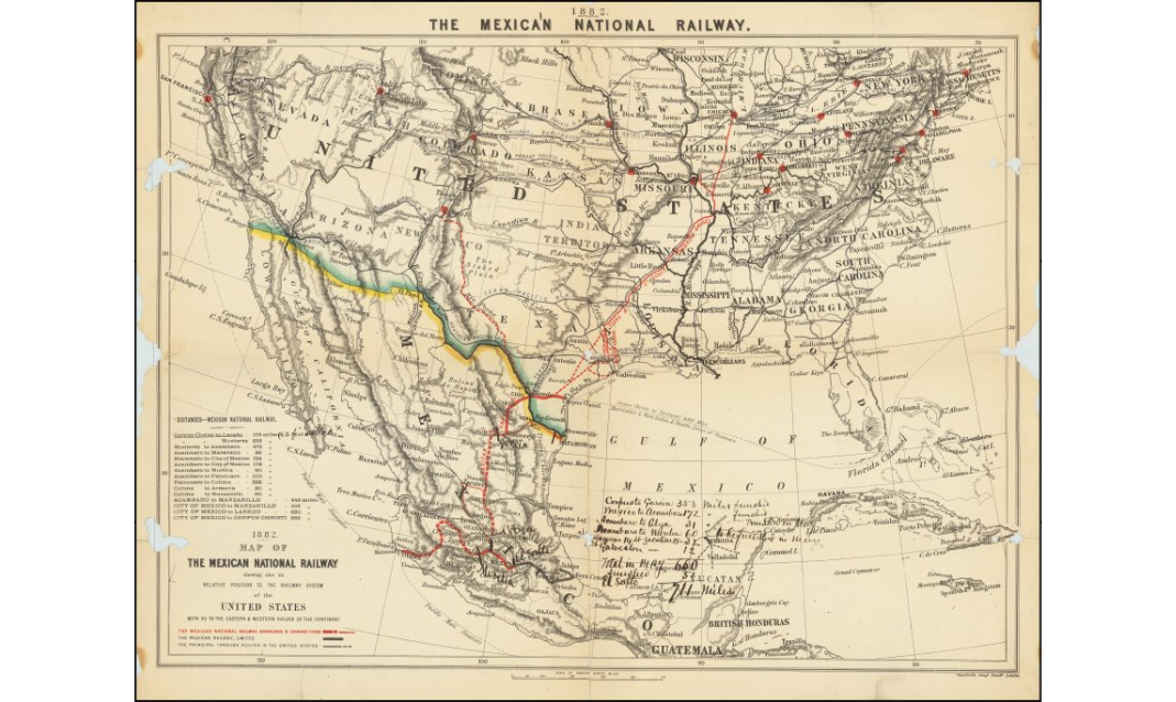 This map of the Mexican national railway highlights connections to Chicago via the Texas & St. Louis Railway. The handwritten annotations (in the Gulf of Mexico) describe track laid after the map was published. This map has been scanned and is available for viewing and download through the Map Library’s Railroad Maps digital collection. Purchased with the assistance of a Library Friend.
Location of German Camps and Hospitals where American Prisoners of War and Civilian Internees are Held
September 18, 2020
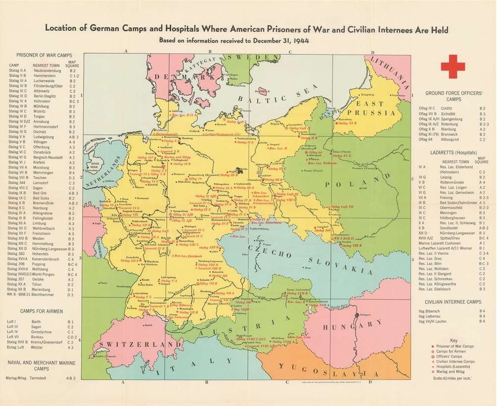 Published in 1945 by the American Red Cross, this map shows where American prisoners of war and civilian internees were being held in German prison camps at the end of 1944. The American Red Cross did not have direct contact with prisoners of war during the Second World War; care packages assembled by the American Red Cross were distributed by the International Committee of the Red Cross. Location of German Camps was published for distribution in the United States. Perhaps because the American Red Cross preferred to put a positive spin on news, the colors selected for this map could be considered “happy.” Purchased with the assistance of a Library Friend.
Soviet Concentration Camps
June 5, 2020
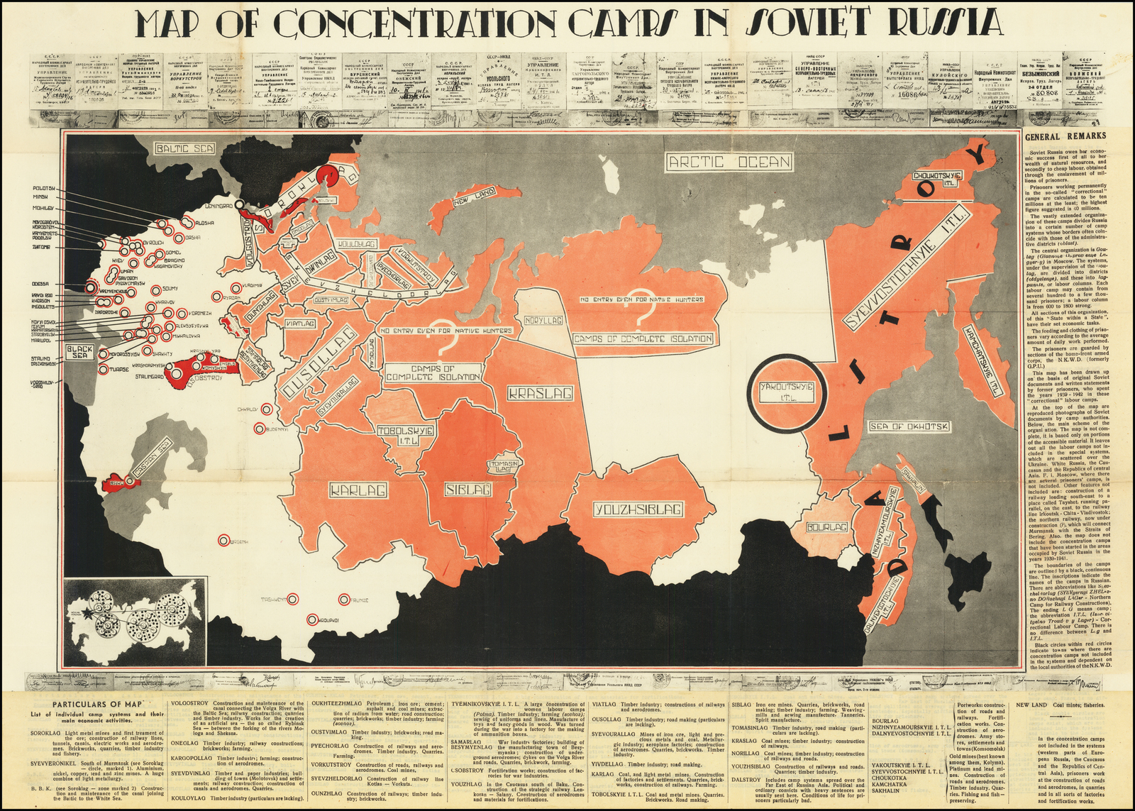 This map is the earliest Cold War era map showing concentration camps, or gulags, in the Soviet Union. It was issued to accompany a book published in Rome in 1945 titled Sprawiedliwość Sowiecka. Purchased with the assistance of a Library Friend, Map of Soviet Concentration Camps joins two other maps, from 1951 and 1973, in the Map Library showing gulag locations.
German Jigsaw
May 14, 2020
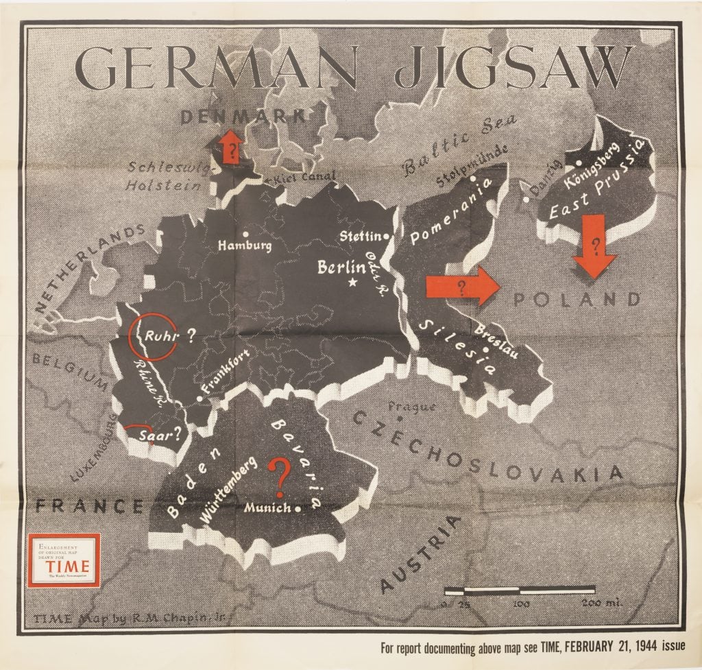
German Jigsaw was purchased for the Map Library with the support of a Library Friend. It is a greatly enlarged version of a map that appeared in the February 21, 1944, issue of Time accompanying a short article titled “Germany: Dismember or Dismantle.” Robert M. Chapin, Jr., the map’s cartographer/artist created many maps for Time between 1937 and the late 1960s. German Jigsaw was published 3 years to the month before the signing of the Paris Peace Treaty. Being speculative, it in no way depicts the changes in borders and territories that actually happened.
Gerrymanders — The Original!
May 7, 2020
 Natural and Political History of the Gerry-Mander!, a broadside published in the late 1810s or early 1820s, includes 2 map images. The map on the left originally appeared in the Boston Gazette in 1812 as a political cartoon, lampooning the odd shape of electoral districts in Essex County, Massachusetts. The less fanciful map of Essex County on the right shows another redistricting effort approximately 8 years later — but the gerrymander still can be seen.