We’ve been lucky to have so many new collections this fall. Bensenville Community Public Library recently joined us and has contributed images from their Bensenville Historical Collection to the IDHH.
Here’s a few I love:
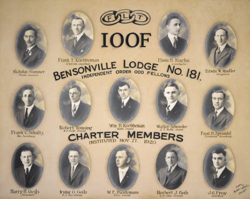
Bensenville Lodge No. 181, Independent Order Odd Fellows, 1920. Bensenville Historical Collection. Bensenville Community Public Library.
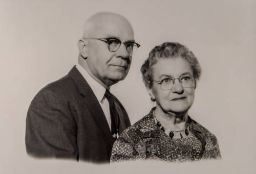
Walter and Alice 50th anniversary, 1967. Bensenville Historical Collection. Bensenville Community Public Library.
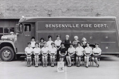
Wives of Bensenville firemen, 1969. Bensenville Historical Collection. Bensenville Community Public Library.
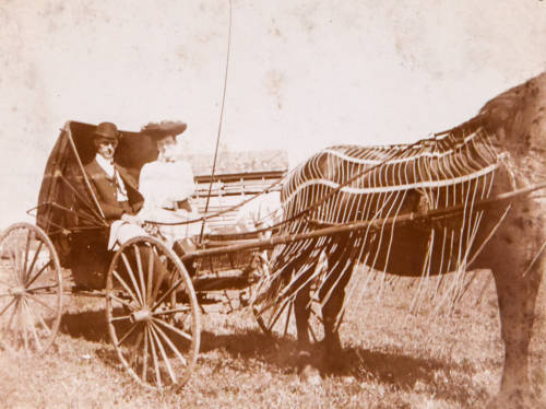
Fred Warnecke and woman sitting in a buggy, c. 1900. Bensenville Historical Collection. Bensenville Community Public Library.
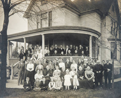
Dierking home family group portrait, 1917. Bensenville Historical Collection. Bensenville Community Public Library.
Hi Readers, we’re delighted that the IDHH is continuing to grow. We’re welcoming LaSalle Public Library and the Illinois Valley Local History Collection.
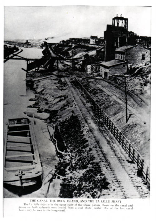
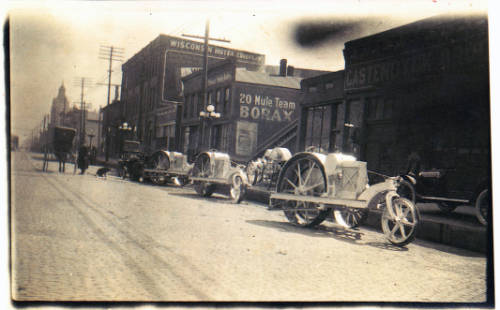
The Illinois Valley Local History Collection is a gem. It includes over 80 photographs from the earliest parts of the 20th century, including images of city life as the city was being built, the Illinois and Michigan Canal, and the coal industry in North Central Illinois.
Here are a few choice images from the full collection:
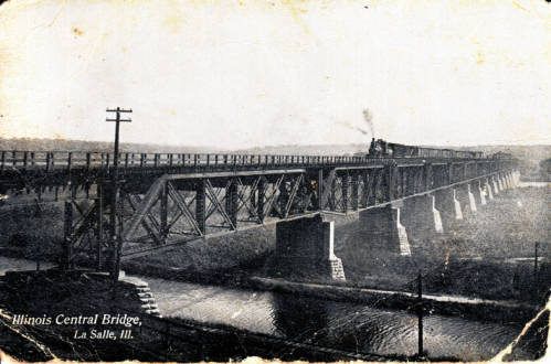
Illinois Central Railroad Bridge, c. 1910. LaSalle Public Library. Illinois Valley Local History Collection.Image courtesy of the LaSalle Public Library.
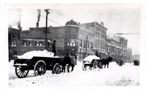
Snow Removal on First Street, c. 1910. LaSalle Public Library. Illinois Valley Local History Collection.Image courtesy of the LaSalle Public Library.
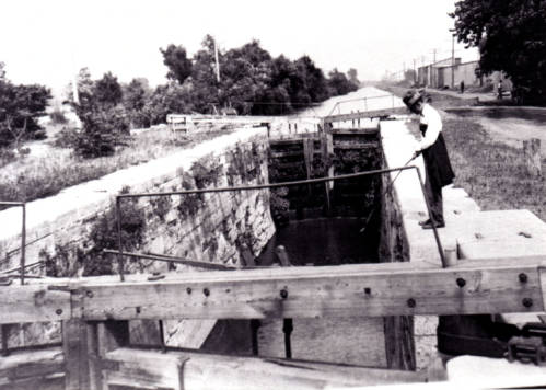
Illinois and Michigan Canal, LaSalle, c. 1910 LaSalle Public Library. Illinois Valley Local History Collection. Image courtesy of the LaSalle Public Library.
LaSalle Carbon Coal Company, c. 1910 LaSalle Public Library. Illinois Valley Local History Collection. Image courtesy of the LaSalle Public Library.
Castendyke Brothers Farm Machinery, c. 1910 LaSalle Public Library. Illinois Valley Local History Collection. Image courtesy of the LaSalle Public Library.
To browse the full collection, please visit the IDHH here.
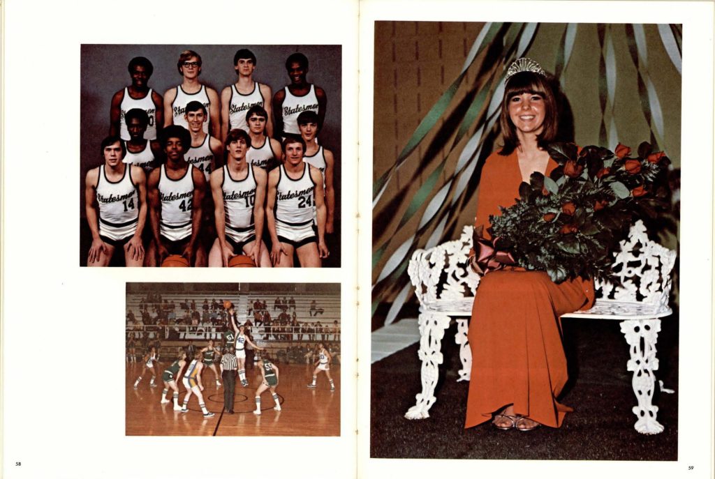
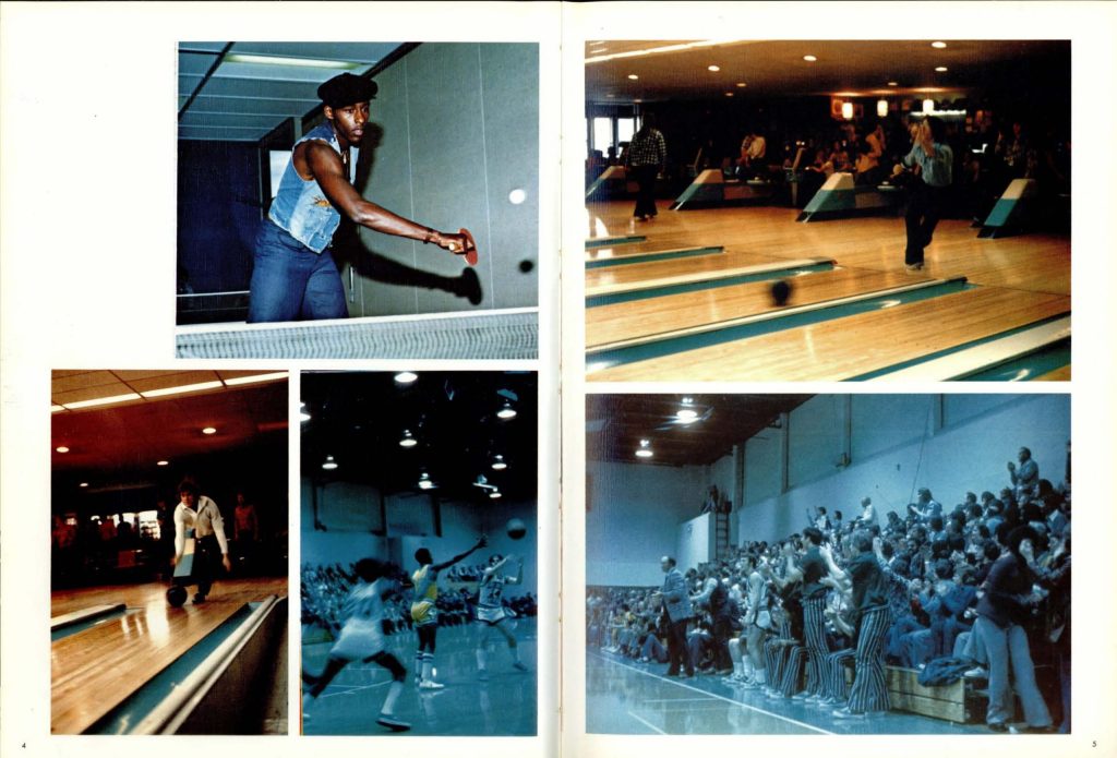
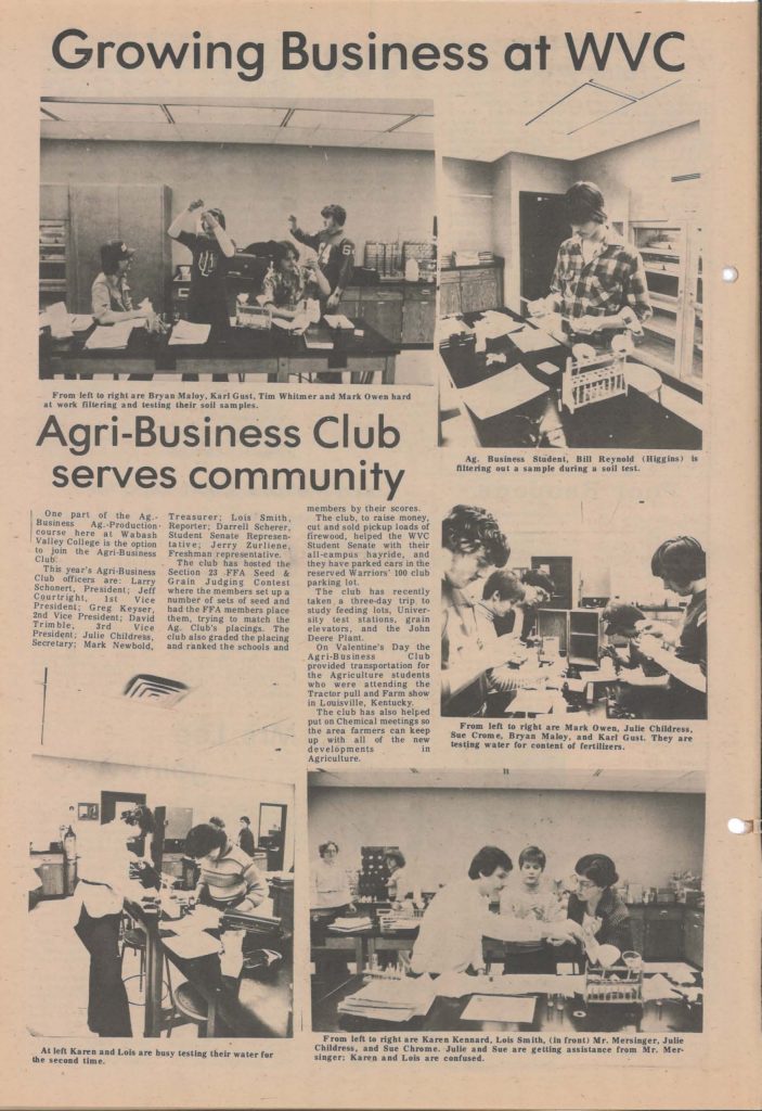
Collections from Illinois Eastern Community Colleges are now available on the IDHH. A district of four community colleges, these collections make a fantastic addition to the Hub, giving us a close look at student and community life, as it happened and documented in yearbooks, newspapers and more.
The LTC Lincoln Logue Collection includes Lincoln Trail College’s yearbooks spanning 1971-1983 with some retro-gems.
LTC Lincoln Logue 1974, Pages 58-59. 1974. Illinois Eastern Community Colleges. LTC Lincoln Logue Collection.
LTC Lincoln Logue 1976, Pages 4-5. 1976. Illinois Eastern Community Colleges. LTC Lincoln Logue Collection.
WVC’s Student Newspapers collection chronicles several different student newspapers beginning in 1968 with the founding of WVC Broadcast. Other local publications are included–relating to WVC history and community.
1979 Back to Campus. Page 32. 1972. Illinois Eastern Community Colleges. WVC Student Newspapers.
The MCHS 2017 Road to Peoria collection tells the story of the Mt. Carmel High School boys basketball team, whose 2017 season led them to their first State Finals game in 90 years.
Step 2: Bishop McNamara – Semi-Final Game, Student Section. 2017 Illinois Eastern Community Colleges. MCHS 2017 Road to Peoria.
Step 2: Bishop McNamara – Semi-Final Game, Jumping Action. 2017 Illinois Eastern Community Colleges. MCHS 2017 Road to Peoria.
For everything from Illinois Eastern Community Colleges, click here to visit the IDHH. Welcome Illinois Eastern Community Colleges!
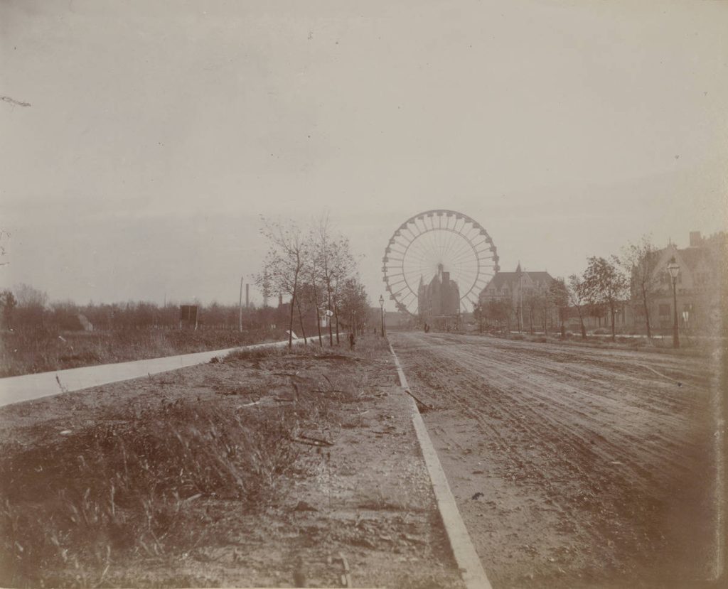
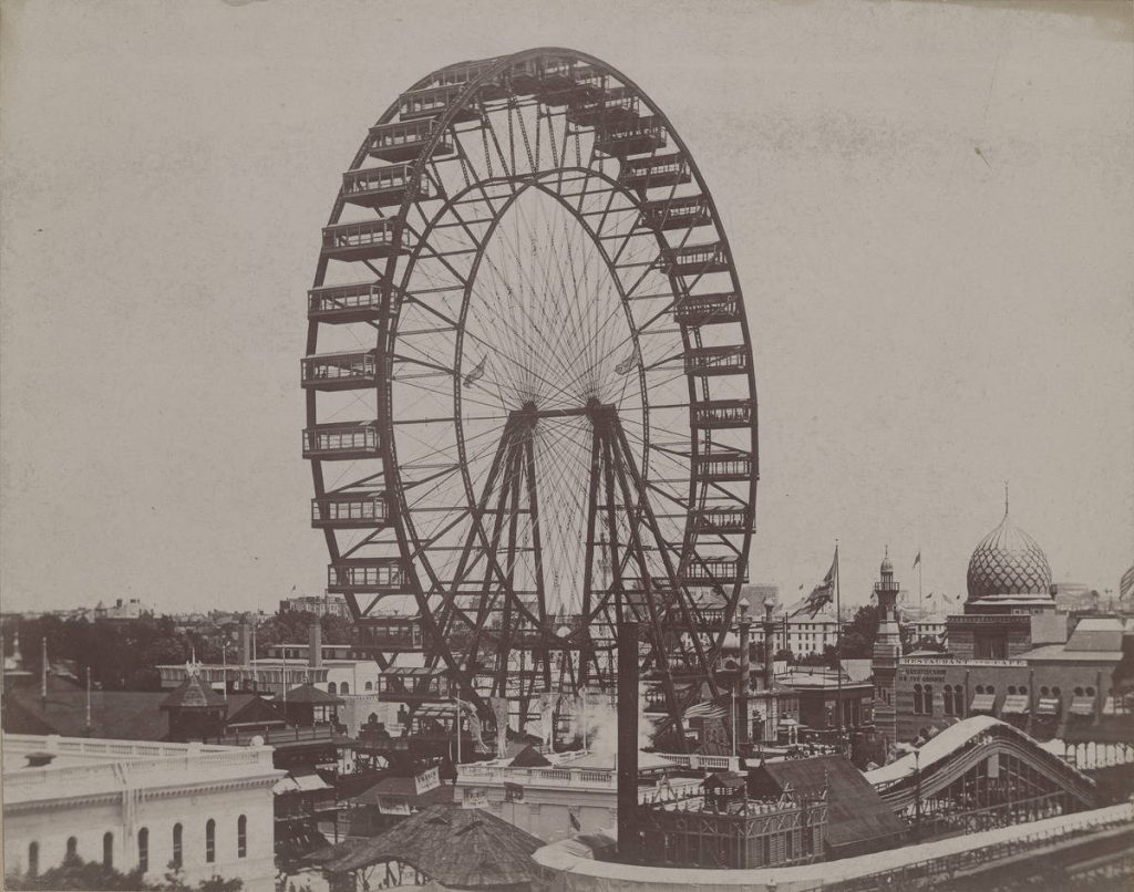
Ferris wheel at the Midway Plaisance. 1893. Chicago History Museum. Prints and Photographs Collection.
It’s pretty well known amongst Chicago History Buffs that the Ferris Wheel debuted on the Midway Plaisance during the 1893 Columbian Exposition. The Ferris Wheel, brainchild of Galesburg-born George Washington Gale Ferris Jr., was the result of architect Daniel Burnham’s challenge to build something to rival Paris’ Eiffel Tower, built as the centerpiece of 1889’s Exposition Universelle, celebrating the centennial of the French Revolution. On this day in history, October 16th 1892, the Ferris Wheel was given the go-ahead for its inclusion in the Columbian Exposition.
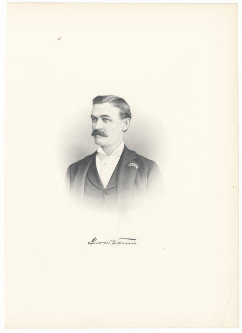
Portrait of George Washington Gale Ferris. c. 1893. Chicago History Museum. Prints and Photographs Collection.
“Make no little plans” Burnham said to a group of architects and engineers at dinner. While eating at Chicago chop house with the same group of architects and engineers Ferris hit on the idea; “I remember remarking that I would build a wheel, a monster. I got some paper and began to sketch it out. I fixed the size, determined the construction, the number of cars we would run, the number of people it would hold, what we would charge, the plan of stopping six times in the first revolution and loading, and then making a complete turn-in short, before the dinner was over I had sketched almost the entire detail” Ferris recalled in an interview.
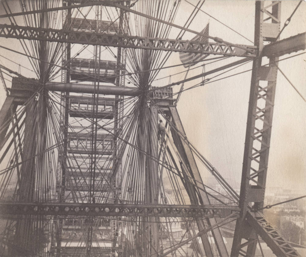
Worker climbing Ferris Wheel spokes. 1893. Chicago History Museum. Prints and Photographs Collection.
Ferris wheel at the World’s Columbian World Fair. 1893. Chicago History Museum. Prints and Photographs Collection. Photograph by J. Maul.
There were wooden wheels that had toured carnival circuits, patented designs even, but steel was a considerable upgrade and had the same modernist industrial touch as the Eiffel tower’s steel beams. Ferris, working out of Pittsburgh was known as an engineer experimenting in steel- to make a steel structure like this- that moved,- and transport the 100,000 parts of it a third of the way across the country for reassembly, was a significant challenge. At the time of its creation the 71 ton axel was the largest single piece of steel in the world.
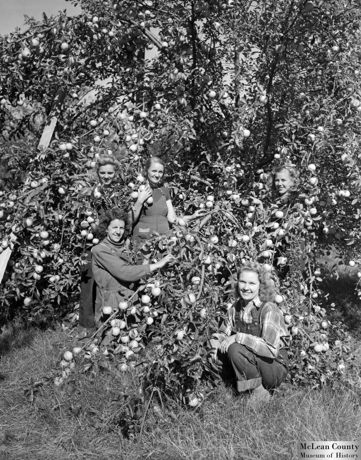
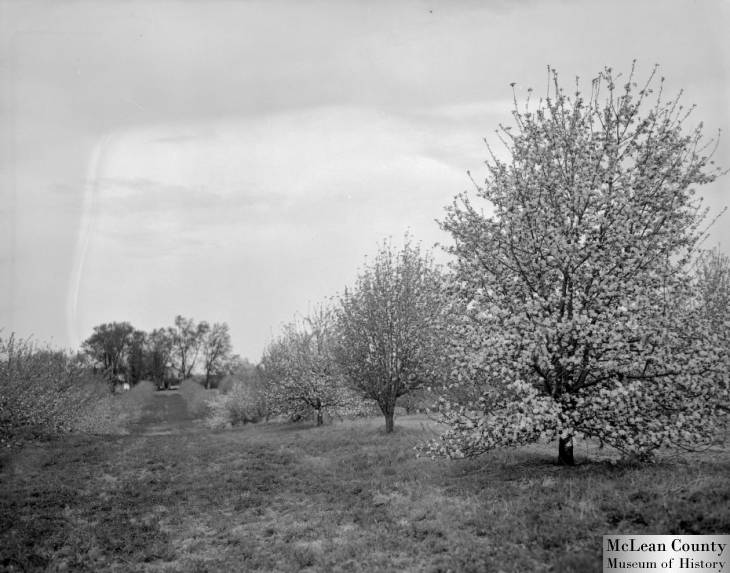
Happy September Y’all. We’re seeing our first 40 degree nights in Central Illinois, and apples are beginning to be harvested. Around Champaign-Urbana, where I’m writing from, hail storms in August significantly damaged the apple crop. One farmer who I talk to at the farmers’ market had ployed to market her hail-damaged apples as “speckled apples”, but this week looked disappointed with just a few lumpy apples.
Here’s two of my favorite pictures in the IDHH from McClean County Museum of History of the over 6,000 taken by Pantagraph photographer Frank Bill in the 1930’s and 1940’s:
Girls Pick Apple Bumper Crop. 1942. McClean County Museum of History. Pantagraph Negative Collection (1940-1945). Photograph by Frank Bill.
Apple Blossoms. 1939. McClean County Museum of History. Pantagraph Negative Collection (1930-1939). Photograph by Frank Bill.
“Main Street of America”, Route 66 is probably the most well known road in America. It’s been featured hundreds of times in American literature and film, from symbolizing escape and grief in Steinbeck’s Grapes of Wrath to the backdrop of Radiator Springs just off Route 66 but forgotten after ‘the Mother Road’ (another Steinbeck reference) was bypassed by Interstate 40.
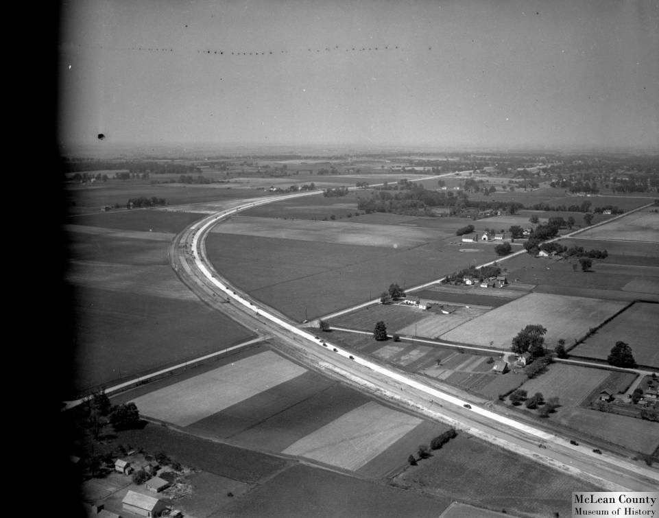
Scoop- Aerial Views. 1941. McClean County Museum of History. Pantagraph Negative Collection (1940-1945). Photograph by Frank Bill.
From Illinois, or perhaps most of the country, Route 66 always looks westward- showing the horizon of the spiritual architecture of Americana. This westerly orientation makes sense, when it opened in 1926 as part of the U.S. Highway System, Route 66 began in Chicago and ran diagonally across the state, like a 300 mile asphalt vein through The Prairie State. You can virtually drive the entirety of “Old U.S. Route 66” in about 3 hours on Google Maps’ street view, but you wouldn’t get the full story of Route 66 before it was largely replaced by the speedier and beefier Interstate 55. Items from our contributors at Towanda Area Public Library, Illinois State Library, Illinois State University, and McLean County Museum of History, capture the spirit of Illinoisan Route 66 as it was in the 1940’s.
Like most roads, Route 66 repurposed other roads and trails, laying a new physical and administrative infrastructure on top of historic passages and routes far preceding car culture. In the earliest part of the 20th century, people traveled between Chicago and Saint Louis on the “Pontiac Trail ”- a native trail, turned unpaved stagecoach byway that travelled southwest through Springfield and the St. Louis area. By 1915 it became IL-4, and ran parallel to Chicago Alton Railroad.
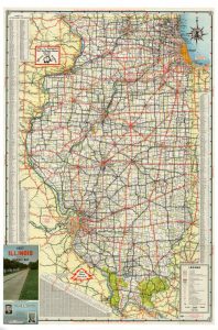
1956-1957 Illinois: Official Highway Map. 1956. Illinois State Library. Illinois State Highway Maps Collection.
The relationship between railroad and road was hot in Illinois. Railroads connected metropolitan areas, small farm towns along the railroads. Towns grew and farmers needed roads to ship their crop. Dirt roads weren’t enough, the roads of Illinois in 1910 were hardly better than the Illinois roads of 1818 according to historian David Wrone. The compact prairie sod was all too vulnerable to the elements; quick to become deep mud that a horse drawing cargo had difficulty picking its way through, and according to Donald Tingley, prompted “automobile pioneers [to store] their machines in the barn until spring. In the summer the mud turned into dust almost as deep.” Motorists, farmers, bankers and cyclists alike began organizing, building associations and committees that sought to advocate for better roads, and investigate solutions. The Tice Road Law of 1913 provided state assistance on roadside improvement for any county which was willing to build and maintain their roads. The Illinois Highway Department integrated a system to connect towns through highways. Illinois’ road story received another push in 1916 when the Federal Aid Road Act was passed, granting Illinois roughly three million dollars between 1917 and 1922.
The newness of these paved roads were politically advantageous for Illinois. Minimal construction meant that the route could open to traffic almost immediately in 1926. The flatness of Route 66 made it a popular truck route. The trucking industry stimulated the local economies it drove through, with small outposts of hotels, restaurants and diners, filling stations, roadside attractions to attract attention for money traveling through.
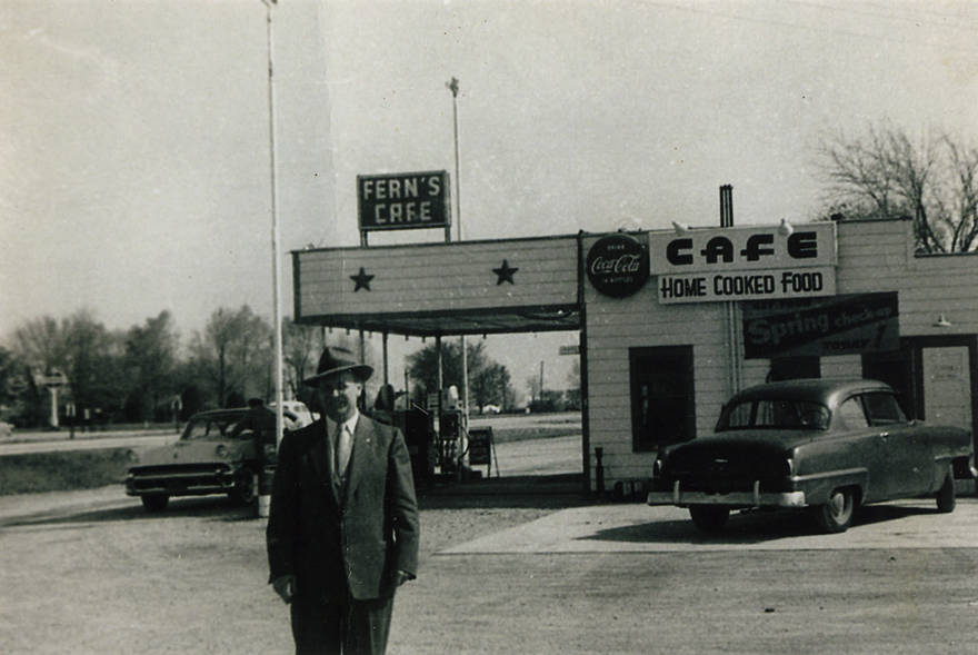
Photograph of Fern’s Cafe. 1954. Towanda District Library. Towanda Area Historical Collection.
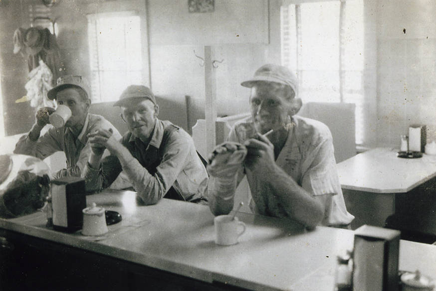
Photograph of Fern’s Café customers in 1954. Towanda District Library. Towanda Area Historical Collection.
With the outbreak of World War II, the highway’s importance exploded as a road for military convoys and equipment transportation. Much of the original pavement was still in service but in poor condition from heavy truck traffic. The Federal Highway Defense Act sought to modernize the highway system, make repairs where needed, and establish a strategic highway network in preparation for war.
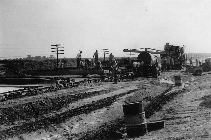
The Federal Highway Defence changed the roads dramatically. Two-lane highways became four-lanes. Route 66’s past as a long vein of county, windy, country roads, had been central to its character. Landmarks were named after it’s most dangerous parts. Illinois newspapers counted pile-ups, injuries, deaths of travellers. So-called “Dead Man’s Curve” in Towanda– a slim sharp curve, was especially treacherous for speeding drivers from Chicago who misjudged the sharpness they’d have to navigate. New portions circumvented these dangerous parts like these.
Photograph of Construction of northbound lanes on Route 66. 1954. Towanda District Library. Towanda Area Historical Collection.
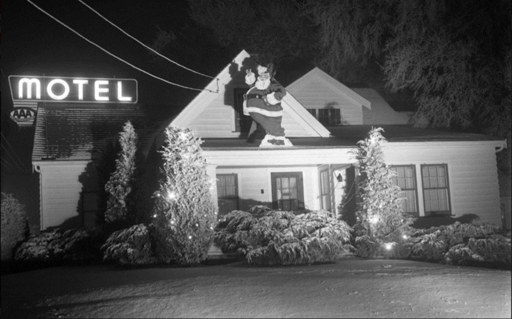
When car and tourism culture took off in the 1950’s the kitschy infrastructure had been well established with its legacy of trucking, and the roads were now safe enough to travel with your family in tow.
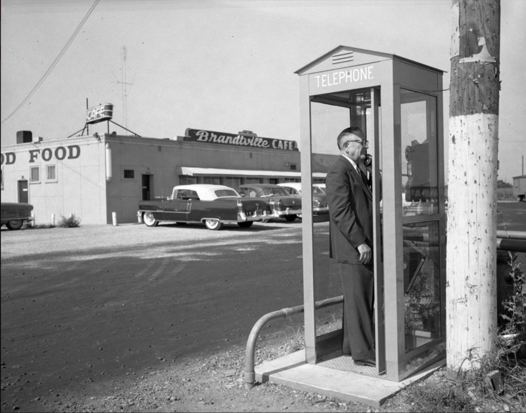
Rusk Haven Motel on Route 66, Bloomington, Illinois. C. 1950. Illinois State University. Ken-Way Studio Archive.Brandtville Cafe with man in phone booth, Bloomington, Illinois. 1955. Illinois State University. Ken-Way Studio Archive.
So, what did the impact of the interstate highway system have on its predecessors? Even while Route 66 was booming with roadside traffic and tourism in mid-1950’s, planning to make it obsolete was already in legislation. The improvements that had been made in the 1940’s to create a strategic highway network of small roads were left in the dust of Eisenhower’s vision for the Interstate Highway System. Inspired by the Reichschautobahn system, Eisenhower saw a fast and safe highway, as critical for economic growth defense, if it was ever needed.
1957. Parts of Route 66 were already being chosen for sections of I-55, I-74, or I-190. Route 66 was travelled less and less, left in increasingly worse disrepair- from over-use and then neglect. The mother road was officially removed from the U.S. Highway System on June 27, 1985. Community efforts have since surged attempting to preserve the highway’s particularity and celebrate it’s off-beat culture that lined rural America for three decades. Cities in Illinois began to register stretches of the route under the Register of Historic Places, citing both the engineering and cultural significance that preceded the interstate and knitted together rural communities alongside the road.
Gas station men on Route 66. 1942. McClean County Museum of History. Pantagraph Negative Collection (1940-1945). Photograph by Leonore Campbell.Highway 1.1944. McClean County Museum of History. Pantagraph Negative Collection (1940-1945). Photograph by Stan Windhorn.
For more of Route 66 from our contributors, click here.
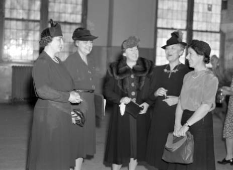
On August 18th 1920, women were finally granted the right to vote in the United States. The Susan B. Anthony-style suffragettes are certainly the most known figures behind the fight for women’s votes, but an entire network of suffragettes across the nation organizing in major cities made the demand clear. The Suffragette movement continued its momentum far into the 20th century with women’s voting advocacy groups such as the League of Women Voters (founded in February 1920) establishing chapters nationwide that continue to fight for people’s participation in elections.
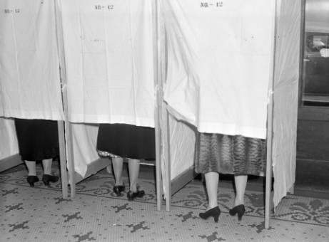
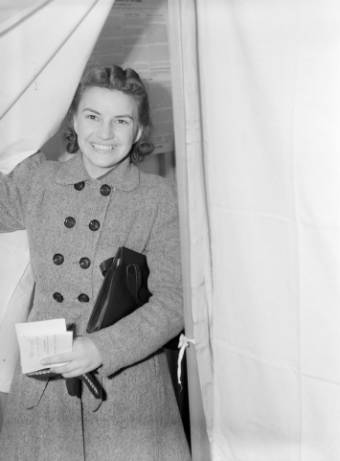
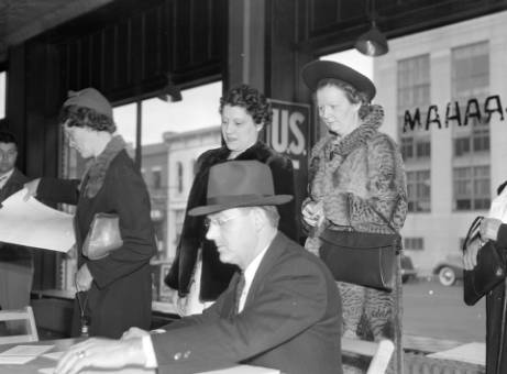
To commemorate 100 years of Votes for Women, here are some of our favorite images of women exercising their right from the McLean County Museum of History’s “Pantagraph Negative Collection”.
Women Voting, 1940. McLean County Museum of History. Pantagraph Negative Collection (1940-1945).
Women Voting, 1940. McLean County Museum of History. Pantagraph Negative Collection (1940-1945).
Women Voting, 1940. McLean County Museum of History. Pantagraph Negative Collection (1940-1945).
League of Women Voters, Pontiac IL, 1941. McLean County Museum of History. Pantagraph Negative Collection (1940-1945)
In March we made a post about Mary Salome Ott Brand, and her first time at the polls as documented by her son Orson Brand and collected by the Highland Park Public Library.
For more on suffrage visit the IDHH’s holdings here.
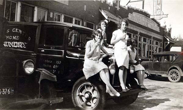
Women Modeling their Wedding Gowns, nd. Sterling Public Library. Sterling and Rock Falls Local History Collection.
My family tells this story about a wedding at a trapeze artist’s house. The bride, the artist herself, had a trapeze installed in her house- an old farmhouse that they connected to the barn after moving it across their property. It was so hot at the wedding that eyeglasses were slipping off of people’s faces- the groom– somebody in investment banking sweat through his clothes and spent the rest of the wedding visibly damp. The pond near their house was alive with snakes trying to both sun themselves and get cool.
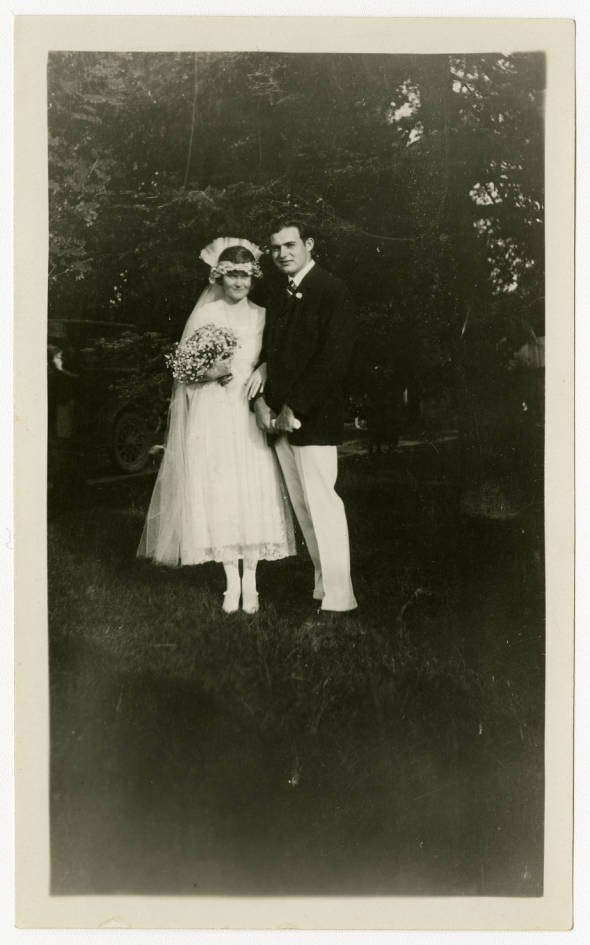
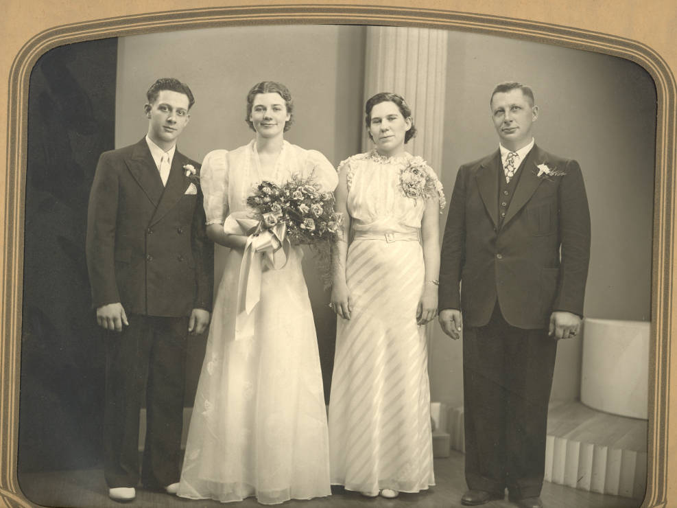
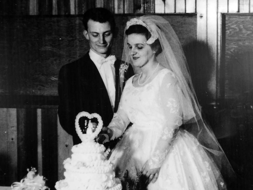
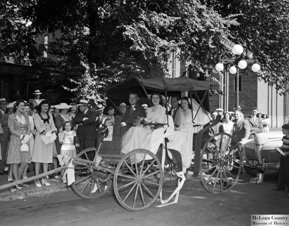
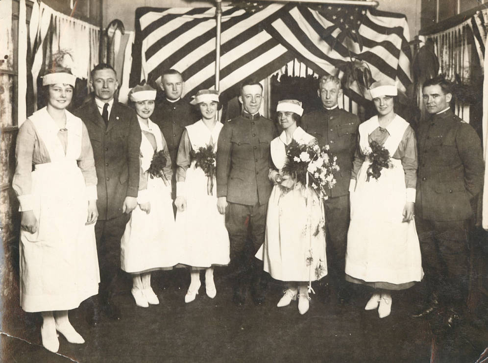
It took time for me to actually understand what “wedding season” was- especially as it coincided with tourist season. The political economy of event planning was so foreign. Who doesn’t love weddings? Or even just photos of weddings, including the notalgia and trends in them, group pictures, flowers, wedding cakes. What makes a good wedding? What makes a good wedding photo beyond the traditional framing or poses that seemingly every married couple gets arranged in on their wedding day? Below are some of my picks of wedding photos from our contributors at Sterling Public Library, Cherry Valley Public Library District, Mclean County Museum of History, Bess Bower Dunn Museum of Lake County, and Ernest Hemingway Foundation of Oak Park in cooperation with the Oak Park Public Library.
Hadley Richardson and Ernest Hemingway on their wedding day. 1921. Ernest Hemingway Foundation of Oak Park in cooperation with the Oak Park Public Library. The Early Years – Ernest and Marcelline Hemingway in Oak Park.
Struckman Family. 1937. Sterling Public Library.Sterling and Rock Falls Local History Collection.
Yunek-Banks Wedding. 1956. Cherry Valley Public Library District. Cherry Valley Local History Collection.Benjamin Wedding. 1944. Mclean County Museum of History. Pantagraph Negatives Collection, 1940-1945.Nurses and Soldiers, General Hospital No. 28, Fort Sheridan, Illinois, c. 1919. Bess Bower Dunn Museum of Lake County. Fort Sheridan.
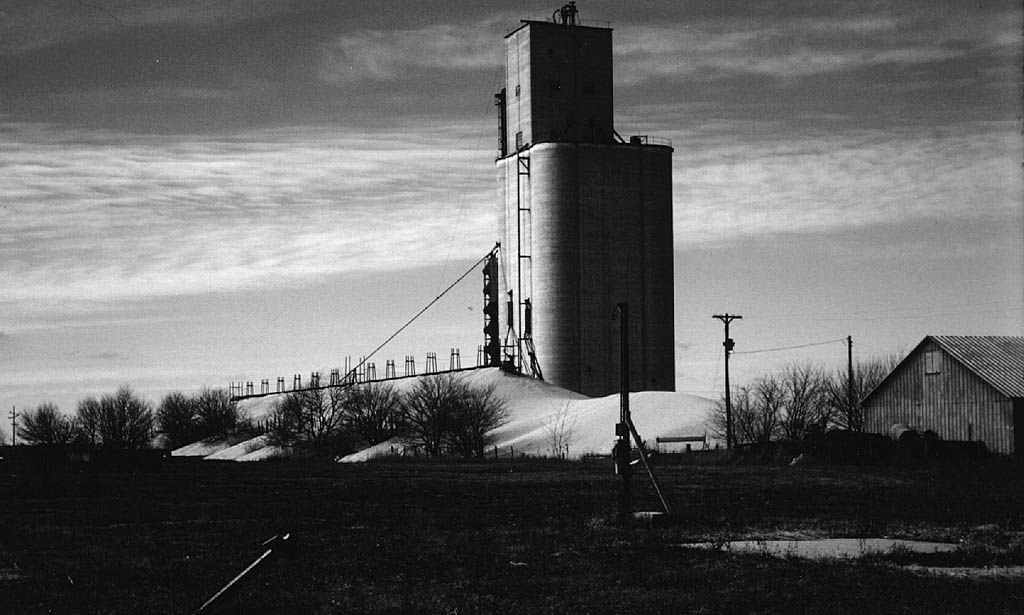
Corn in Illinois will not be ready for harvest for another month, but the opportunity to celebrate our corn heritage is too enticing. It’s a small contribution, and a little bit of a deviation from the theme but this image of excess corn stored outside of an elevator from McLean County Historical Society via the McLean County Museum of History is too good to not share.
Excess corn stored outside elevator. C. 1950. McLean County Historical Society via McLean County Museum of History. Teaching with Cultural Heritage.
A dune of corn kernel surrounds the concrete elevator as less than ideal but temporary storage. Advances in industrial agriculture in the 1950’s and 60’s occasionally created such an abundant harvest that the infrastructure for storing corn struggled to keep up.
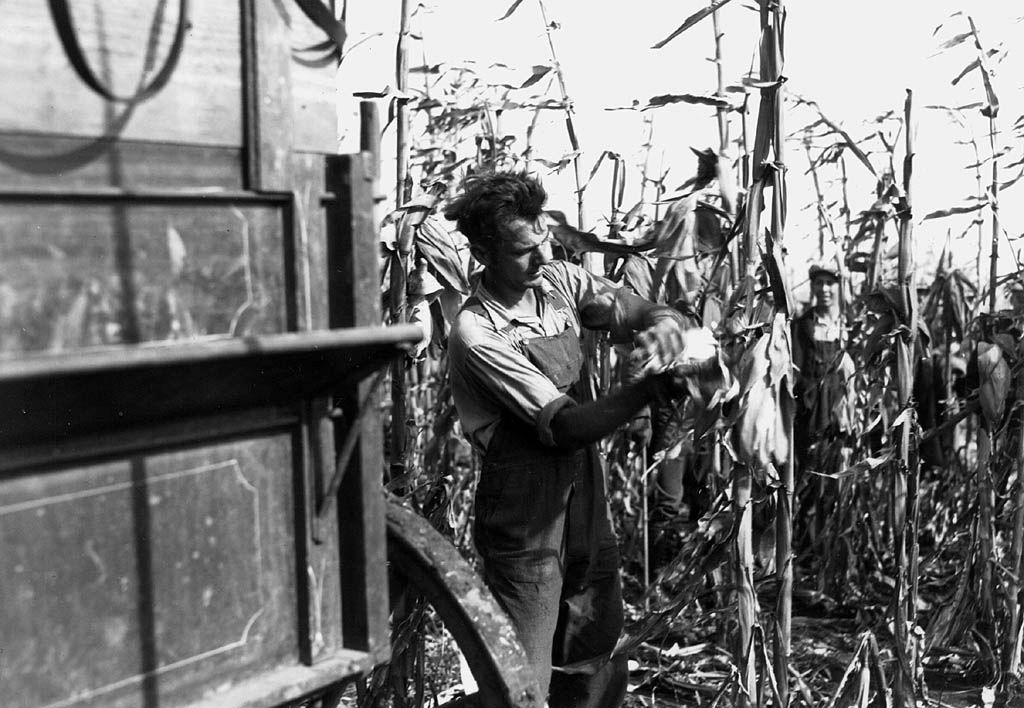
Husking Corn By Hand. C. 1910. McLean County Historical Society via McLean County Museum of History. Teaching with Cultural Heritage.
In the same way that communities in Illinois revolved around coal, corn also was a community-wide touchpoint that was generously documented by everyday people and journalists. For more on corn in Illinois visit the IDHH.