Mapping History at the University of Illinois Collection
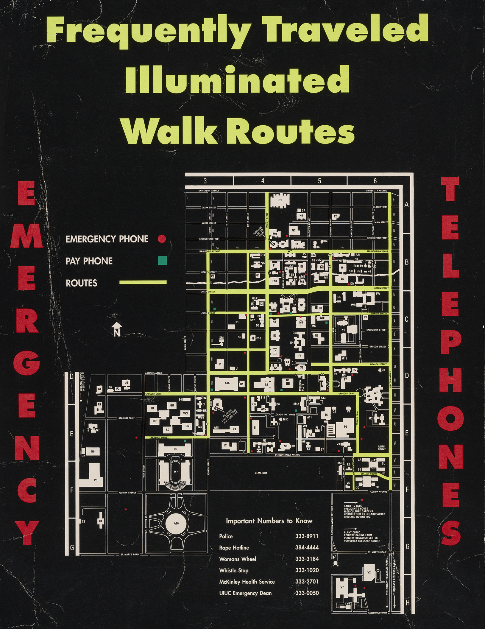
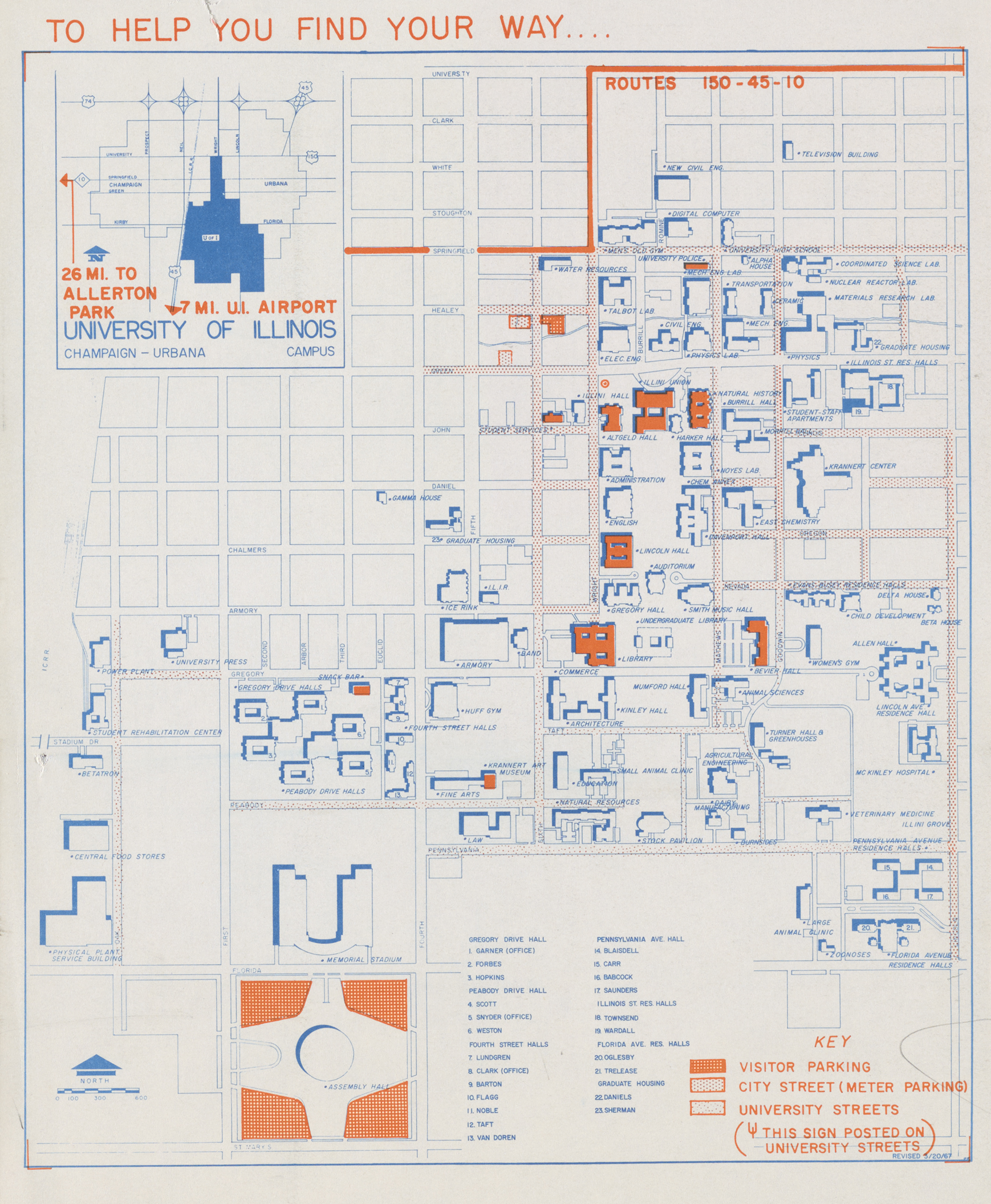
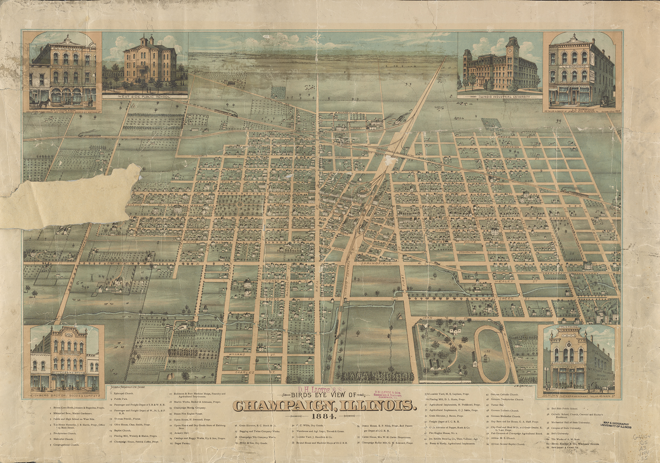
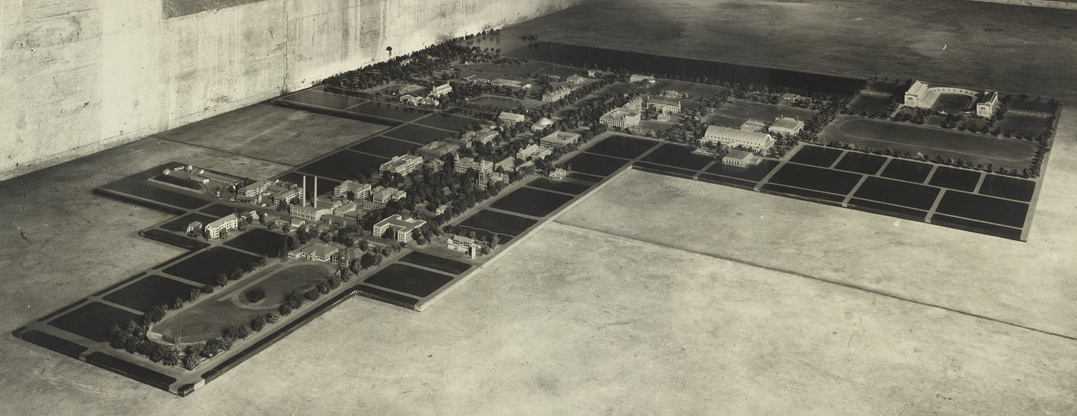
The Mapping History at the University of Illinois (MH@UI) collection contains maps, drawings, blueprints, and images of the University of Illinois, Champaign-Urbana, and Champaign County dating from the 1850s to the present. Maps relate to way-finding, campus and community planning, city zoning, political districting, transportation, humor and cartooning, student housing, recreational offerings, faculty club outings, and more. The MH@UI project is a collaboration of the University of Illinois Archives, University Library’s Scholarly Commons- GIS, and the Illinois School of Architecture.
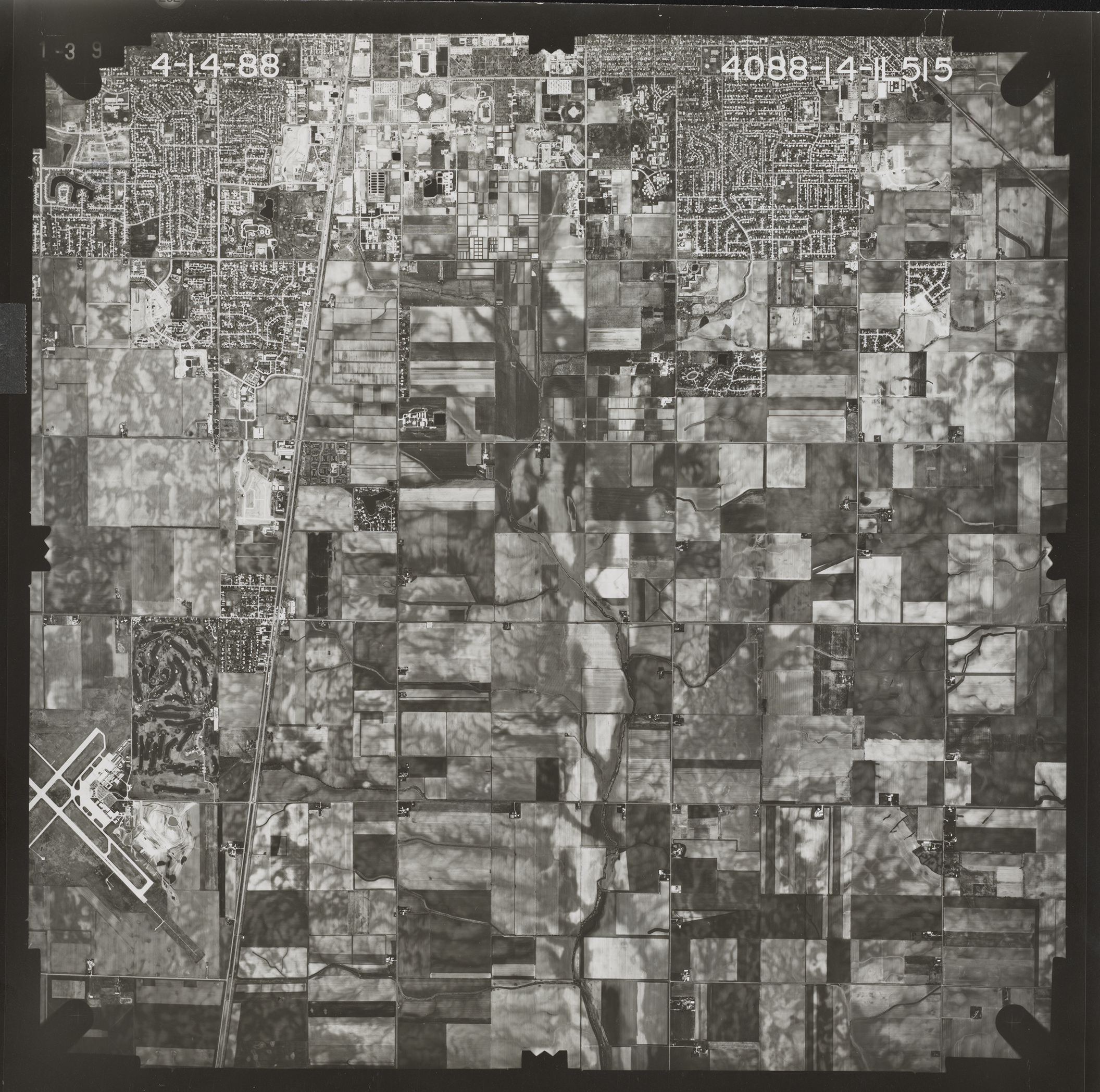
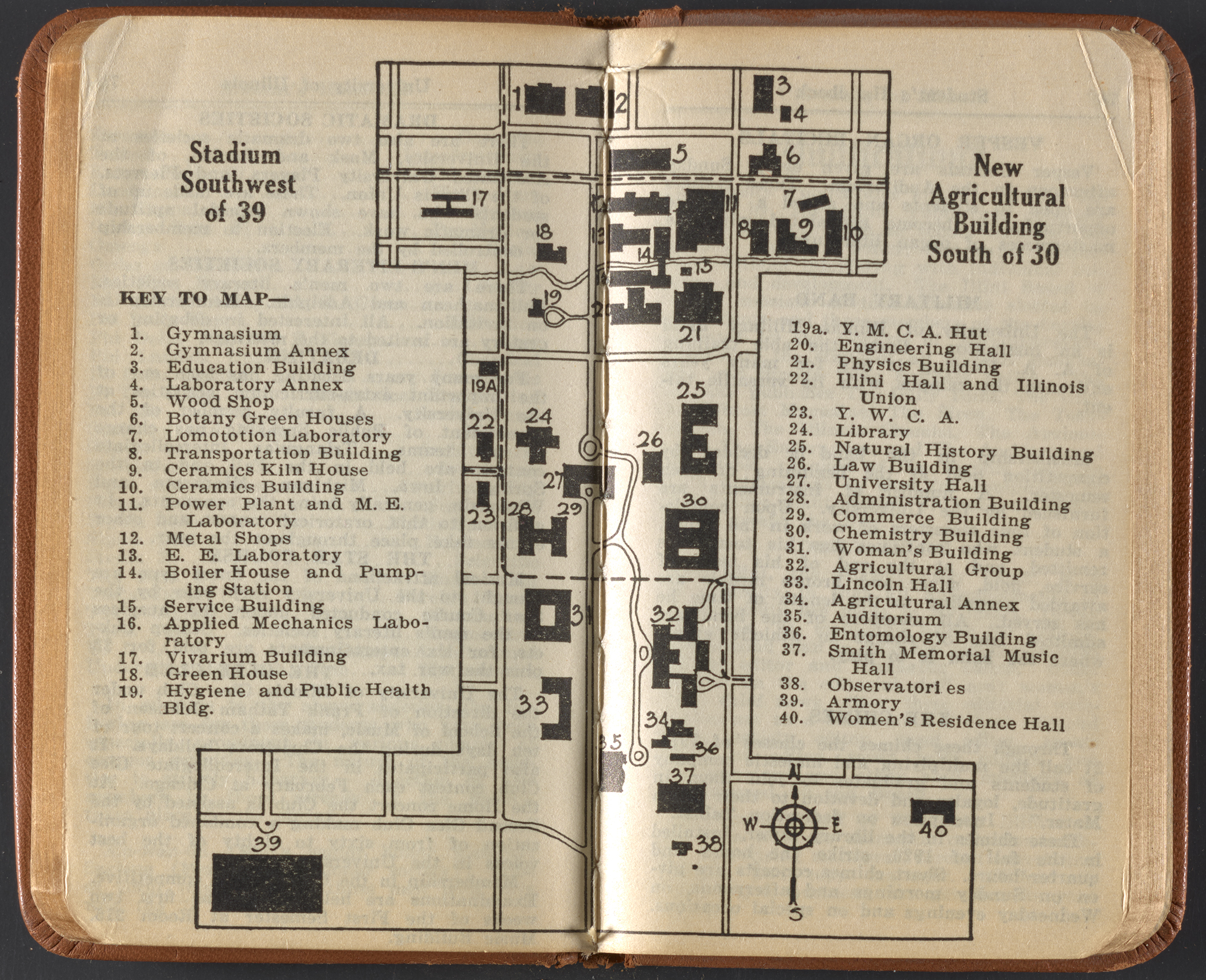
Holdings are from the collections of the University Archives, Map Library, and Champaign County Historical Archives.